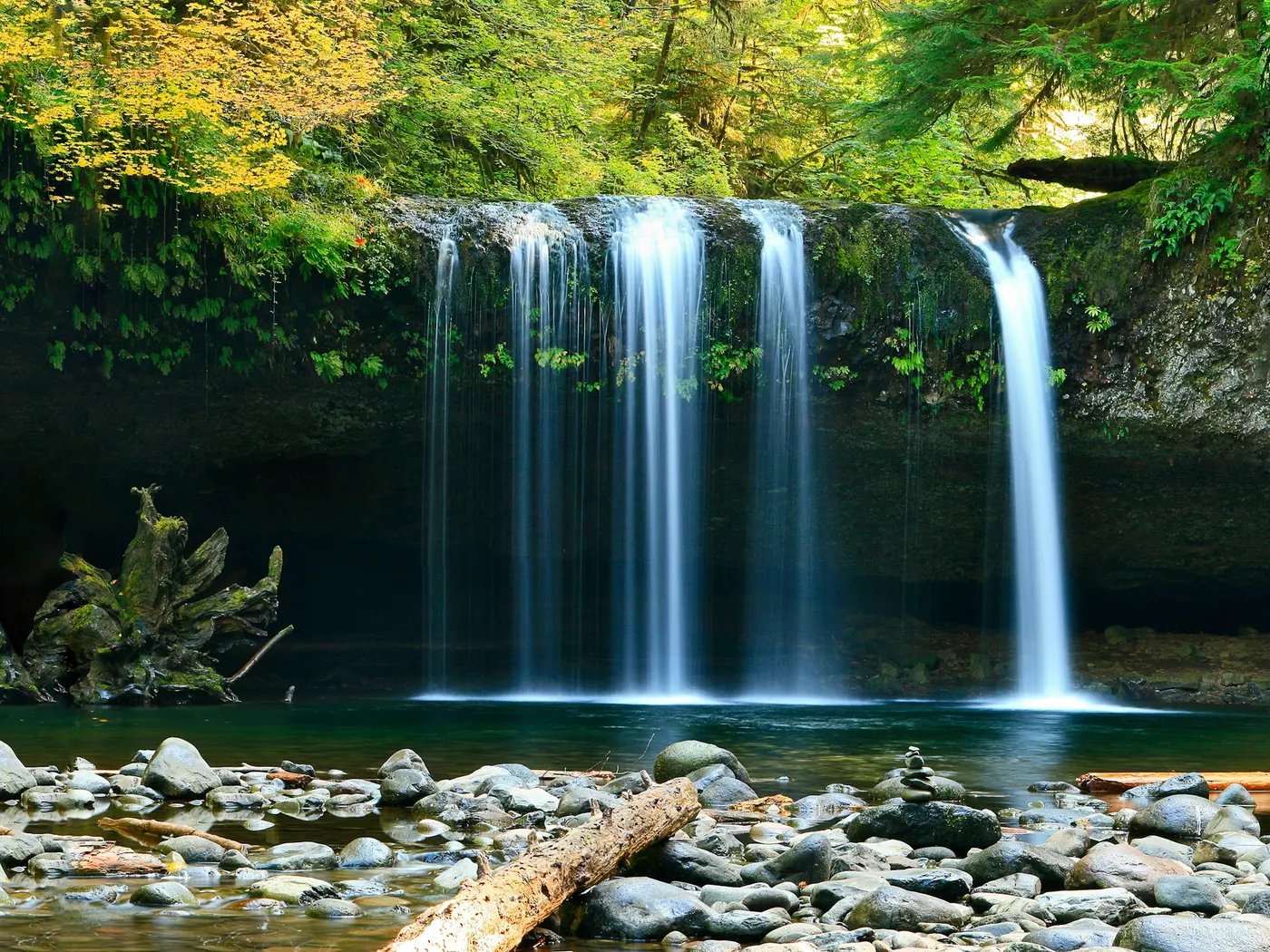
Anvil Rock
Swimming hole in Lewisburg, West Virginia · River
Anvil Rock is a river swimming hole. It is near Lewisburg, West Virginia. Access is free. Best season: Summer is a strong choice for swimming, typically June through August, while spring and fall offer stunning foliage and cooler hiking conditions.
Typical season: Summer is a strong choice for swimming, typically June through August, while spring and fall offer stunning foliage and cooler hiking conditions
About Anvil Rock
Anvil Rock gives you river swimming access near Lewisburg in West Virginia. Expect a natural bank, not a built beach. This unofficial but beloved natural gathering spot sits an easy day trip from Lewisburg, Ronceverte, and Alderson, offering a raw, unpolished slice of Appalachian river life that no developed park can replicate. There are no snack bars, no lifeguards, no amenities of any kind. Just the river, the rock, and the sky above the ridge. The star of the show is the namesake formation itself: a striking anvil-shaped rock that juts out over the Greenbrier River with an almost sculptural confidence. Older children and active adults will manage it well, but it's worth taking your time on the way down. Once you arrive at the water's edge, the effort melts away. Hardwood forest crowds the banks, filtering afternoon light into shifting patterns on the water. In spring and fall, the hillsides ignite with color, and the surrounding landscape hums with birdsong and the rustling of native wildlife. Even in winter, the site rewards the determined visitor with icy, photogenic stillness. Summer. Particularly June through August. Is the sweet spot for swimming, when water temperatures climb to a refreshing but bearable level and the warm air makes the cold plunge feel like a reward. The anvil-shaped rock draws those with a taste for adventure: it serves as a natural jumping platform, offering a genuine thrill for those willing to launch themselves into the river below. Swim at your own risk at Anvil Rock. Check conditions after rain and respect any posted closures.
Key facts
Structured details for trip planning — verify access and fees with the land manager before you visit.
- Water type
- River
- Water body
- Greenbrier River
- Fee
- Free
- Nearest town
- Lewisburg
- State
- West Virginia
- Coordinates
- 37.72890, -80.59670
- Best season
- Summer is a strong choice for swimming, typically June through August, while spring and fall offer stunning foliage and cooler hiking conditions. Winter provides solitude and icy scenic beauty for photography enthusiasts.
- Access difficulty
- Moderate. The descent to the river is steep and uneven, requiring careful navigation. Suitable for active individuals and older children.
- Parking
- Designated area
- Restrooms
- None on site
- Lifeguard
- None — assume unguarded
- Cliff jumping
- Reported
- Camping
- Nearby at Greenbrier State Forest (a short distance east of Lewisburg).
- Activities
- Swimming, Jumping (check depth first)
- Facilities
- No facilities available. You should pack water, snacks, and other necessities. Nearby camping options at Greenbrier State Forest offer additional amenities.
- Listing last updated
- May 12, 2026
The experience
- Best time to visitSummer is a strong choice for swimming, typically June through August, while spring and fall offer stunning foliage and cooler hiking conditions. Winter provides solitude and icy scenic beauty for photography enthusiasts.
- AccessModerate. The descent to the river is steep and uneven, requiring careful navigation. Suitable for active individuals and older children.
- FacilitiesNo facilities available. You should pack water, snacks, and other necessities. Nearby camping options at Greenbrier State Forest offer additional amenities.
- Camping nearbyNearby at Greenbrier State Forest (a short distance east of Lewisburg).
Highlights & features
- Striking anvil-shaped rock formation
- Crystal-clear Greenbrier River
- Thrilling jumping opportunities
- Seasonal foliage and wildlife
- Nearby camping at Greenbrier State Forest
- Anvil-shaped rock ideal for jumping
- Secluded location without facilities
- Dynamic seasonal scenery
How to get there
Anvil Rock lies in West Virginia near Lewisburg, Ronceverte, and Alderson. Use these driving notes as a starting point and confirm road conditions before you go. Anvil Rock is a scenic swimming destination. Follow the turn-by-turn directions below to reach the site safely and efficiently. Driving Directions:
Starting Point: Lewisburg, WV
Begin your journey by heading south on Route 219 (US-219) toward Ronceverte.
Turn onto Route 63
Once you reach Ronceverte, turn west onto Route 63 (WV-63). This road will lead you toward the Greenbrier River area. Pass the Greenbrier River Campground Continue driving on Route 63. Look for the Greenbrier River Campground sign as a landmark. Once you pass the campground, continue driving for about 1.5 miles. Locate the Gravel Pull-Out After traveling 1.5 miles past the campground, look for a wide gravel pull-out on the south (left) side of the road. This is where you will park your vehicle.
Parking and Final Approach
Park your vehicle in the gravel pull-out. Ensure your car is securely parked and not obstructing the road. From the parking area, walk to the edge of the pull-out. You will see Anvil Rock below. Carefully descend the steep bank to reach the river. Exercise caution, as the trail down to the river may be uneven or slippery.
Additional Notes
Wear sturdy footwear for the descent to the river, as the bank is steep and may require careful footing. Be mindful of your surroundings and pack out any trash to preserve the natural beauty of the area. Plan accordingly. Have a safe visit to Anvil Rock and the refreshing waters of the Greenbrier River! Bring water, sunscreen, and gear for a primitive swim day. Weekends and holidays can draw more visitors. Check local updates on access and water levels before you leave home.
Plan your visit
Anvil Rock works well as a day trip from Lewisburg or Ronceverte. Stock up in town, then head to the water with food, water, and sun protection. Pair the swim with a stop at Sandstone Falls (about 17 mi away) or browse more West Virginia river spots in our directory. For the full list in West Virginia, see our state directory.
Access & fees
Access is via an unofficial, steep bank descent from a roadside pull-out. There is no designated fee, but visitors should be prepared for a primitive experience with no maintained facilities. Parking is in a gravel pull-out along Route 63.
Frequently asked questions
Can you swim at Anvil Rock?
Yes. Anvil Rock near Lewisburg, Ronceverte, and Alderson in WV is a river swimming spot on Greenbrier River. Scout depth and current before entering — no lifeguards at most natural access points.
Is Anvil Rock free?
Access is generally free (fee listed as “No”). Confirm any parking or day-use rules on site, and pack out trash.
How do you get to Anvil Rock?
Anvil Rock is in WV within day-trip range of Lewisburg, Ronceverte, and Alderson. Use a current map for the put-in or park entrance; cell service can be limited at remote spots.
Explore more nearby swimming guides
Nearby swimming holes
Map & location
Culture & history
Anvil Rock reflects the rugged spirit of West Virginia, with its name evoking the region’s industrious heritage. The nearby towns of Lewisburg and Ronceverte add historical charm and cultural depth to the area.
Conservation
Follow Leave No Trace principles. Protect the Greenbrier River by avoiding pollution and minimizing disturbances to local wildlife and vegetation.
Sources & updates
Reference sources
Spotted outdated access, fees, or safety info? Send a correction with the page URL — we review every submission.