Cold River Swimming Holes Of Western Maine
Swimming hole in Bethel, Maine · River
Cold River Swimming Holes Of Western Maine is a river swimming hole. It is near Bethel, Maine. Fee notes: None (trailhead parking rules vary). Best season: Late spring through early fall (May to September) offers optimal conditions with warmer weather and clearer trails.
Typical season: Late spring through early fall (May to September) offers optimal conditions with warmer weather and clearer trails
About Cold River Swimming Holes Of Western Maine
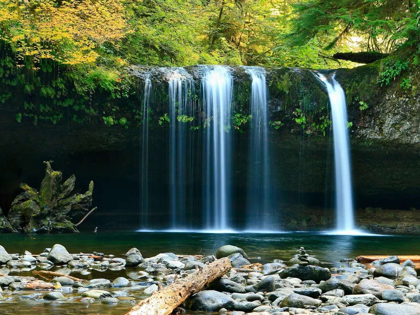
Cold River Swimming Holes Of Western Maine gives you river swimming access near Bethel in Maine. Expect a natural bank, not a built beach. Carved over millennia by mountain brooks tumbling through granite and glacial debris, these natural pools sit within a landscape of towering conifers, moss-draped boulders, and the kind of deep, cathedral silence that only old-growth forest can produce. This is . No ropes, no lifeguards, no snack bars. Just cold, clear water and the sound of moving current. The two crown jewels of this stretch are Rattlesnake Pool and Emerald Pool, each with its own distinct personality. Rattlesnake Pool earns its reputation through color alone. The water holds a naturally emerald hue that seems almost impossible, the result of light filtering through dense forest canopy and refracting off pale, smooth riverbed stone. Emerald Pool, downstream and slightly more dramatic, rewards bolder visitors with high jumping rocks that draw a loyal following of thrill-seekers every summer. Both pools are surrounded by dense woodland that enhances the sense of seclusion, and the gorges and small waterfalls feeding each pool create a backdrop that photographers and painters return to season after season. Wildlife is abundant. Keep your eyes open for songbirds, white-tailed deer, and the occasional great blue heron picking its way along the shallows. No lifeguards patrol Cold River Swimming Holes Of Western Maine. Facilities are limited, so judge depth, current, and weather when you arrive.
Key facts
Structured details for trip planning — verify access and fees with the land manager before you visit.
- Water type
- River
- Water body
- Varies-see below
- Fee
- None (trailhead parking rules vary)
- Nearest town
- Bethel
- State
- Maine
- Coordinates
- 44.25610, -70.97580
- Best season
- Late spring through early fall (May to September) offers optimal conditions with warmer weather and clearer trails. Autumn visits showcase vibrant foliage.
- Access difficulty
- Moderate. Both .5, 0.75 miles on marked trails with varying terrain.
- Parking
- Designated area
- Restrooms
- None on site
- Lifeguard
- None — assume unguarded
- Cliff jumping
- Reported
- Camping
- Two developed campgrounds along RT 113.
- Activities
- Swimming, Jumping
- Facilities
- No facilities directly at the swimming area. Developed campgrounds are available nearby along Route 113.
- Listing last updated
- May 12, 2026
The experience
- Best time to visitLate spring through early fall (May to September) offers optimal conditions with warmer weather and clearer trails. Autumn visits showcase vibrant foliage.
- AccessModerate. Both .5, 0.75 miles on marked trails with varying terrain.
- FacilitiesNo facilities directly at the swimming area. Developed campgrounds are available nearby along Route 113.
- Camping nearbyTwo developed campgrounds along RT 113.
Highlights & features
- Emerald-green waters of Rattlesnake Pool
- Deep dives and jumps at Emerald Pool
- Scenic hiking trails leading to swimming spots
- Wildlife and plant life in surrounding forests
- Photography opportunities with waterfalls and gorges
- Rattlesnake Pool's naturally emerald waters
- Emerald Pool's high jumping rocks
- Secluded upper pools for quiet swimming
How to get there
Cold River Swimming Holes Of Western Maine lies in Maine near Bethel, Gilead. Use these driving notes as a starting point and confirm road conditions before you go.
Rattlesnake Pool (Rattlesnake Brook) Driving Directions
Begin in Bethel, Maine. Take Route 2 west toward Gilead.
In Gilead, turn onto Route 113 south. This is a scenic road that crosses into New Hampshire. After crossing into New Hampshire, continue on Route 113 south for about 1 mile.
Turn left (east) onto Stone House Road.
Follow Stone House Road and turn right (south) onto Shell Pond Road.
Drive to the end of Shell Pond Road and park at the gate. Trail Directions
From the parking area, hike along the road for about 0.5 miles until you reach a grassy area used as a landing strip. From the landing strip, follow the Stonehouse Trail north for a little over 0.5 miles to a wooden footbridge. At the footbridge, look to the left to see a waterfall in the distance. This waterfall has cut a gorge about 20 feet deep into the rock. To access the : Continue past the bridge and take a small side trail to the left. This trail curves around to the falls. You can swim in the small pool above the falls or cross the stream to reach the larger pool under the falls. Alternatively, take a right side trail just before the bridge to reach a deeper pool to the right of the bridge. This pool is less secluded but still suitable for swimming.
Helpful notes
Bathing suits are customary when families are present but optional at other times. The most secluded . GPS Coordinates: Latitude 44.2561, Longitude -70.9758 Google Maps Link: 44.2561, -70.9758
Emerald Pool (Charles Brook) Driving Directions
Begin in Bethel, Maine. Take Route 2 west toward Gilead.
In Gilead, turn onto Route 113 south. This is a scenic road that crosses into New Hampshire. Continue on Route 113 south for about 1.25 miles past Stone House Road. Look for the trailhead for the Baldface Circle Trail on your right and park here. If you reach the Cold River AMC campground, you have gone too far. Trail Directions: From the parking area, follow the Baldface Circle Trail west for about 0.75 miles. Look for a minor gorge along Charles Brook. The Emerald Pool lies here.
Helpful notes
The pool is quite deep, about 12 feet in the middle, and features rocks on both sides that allow jumps ranging from 6 inches to 12 feet. Bathing suits are customary when families are present but optional at other times. A smaller pool above the falls is traditionally used when families are below. Emerald Pool can be crowded during summer youth camp season, so the upper pool may be a quieter option. GPS Coordinates: Latitude 44.23753, Longitude -71.0286 Google Maps Link: 44.23753, -71.0286 Have a safe visit to the Cold River ! Always practice Leave No Trace principles and respect the natural environment. Bring water, sunscreen, and gear for a primitive swim day. Weekends and holidays can draw more visitors. Check local updates on access and water levels before you leave home.
Plan your visit
Cold River Swimming Holes Of Western Maine works well as a day trip from Bethel or Gilead. Stock up in town, then head to the water with food, water, and sun protection. Pair the swim with a stop at Jackson Falls (about 12 mi away) or browse more Maine river spots in our directory. For the full list in Maine, see our state directory.
Access & fees
These are unofficial, natural swimming holes with no facilities, fees, or lifeguards. Parking is at trailheads; access requires a hike. Water conditions like depth and current vary seasonally. Respect private property and follow all posted signage.
Frequently asked questions
Can you swim in Cold River Maine?
Yes. Western Maine’s Cold River corridor near Bethel / Gilead has clear emerald pools (including Rattlesnake and Emerald Pool) reached by short forest hikes. No lifeguards.
Is Cold River swimming free?
Yes. Access is generally free. Some trailheads have limited parking — arrive early and pack out trash.
How do you get to Cold River swimming holes?
Bethel, follow mountain roads toward Gilead and the Cold River / Evans Notch approaches, then hike to each pool. Cell service is limited.
Is jumping safe at Emerald Pool?
Only after you personally check depth and obstacles. Never dive headfirst; wet rock is extremely slippery.
Explore more nearby swimming guides
Nearby swimming holes
Map & location
Culture & history
Bethel and Gilead’s historical roots date back to the 19th century, with Gilead named for its Balm of Gilead trees. The Cold River Area reflects Maine’s rugged and unspoiled wilderness.
Conservation
Visitors should adhere to Leave No Trace principles by carrying out trash, avoiding wildlife disturbance, and preserving the area’s natural features.
Sources & updates
Reference sources
Spotted outdated access, fees, or safety info? Send a correction with the page URL — we review every submission.