Hammersley Hole
Swimming hole in Williamsport, Pennsylvania · Creek
Hammersley Hole is a creek swimming hole. It is near Williamsport, Pennsylvania. Access is free. Best season: Late May to early September for optimal weather and warmer water temperatures.
Typical season: Late May to early September for optimal weather and warmer water temperatures
About Hammersley Hole
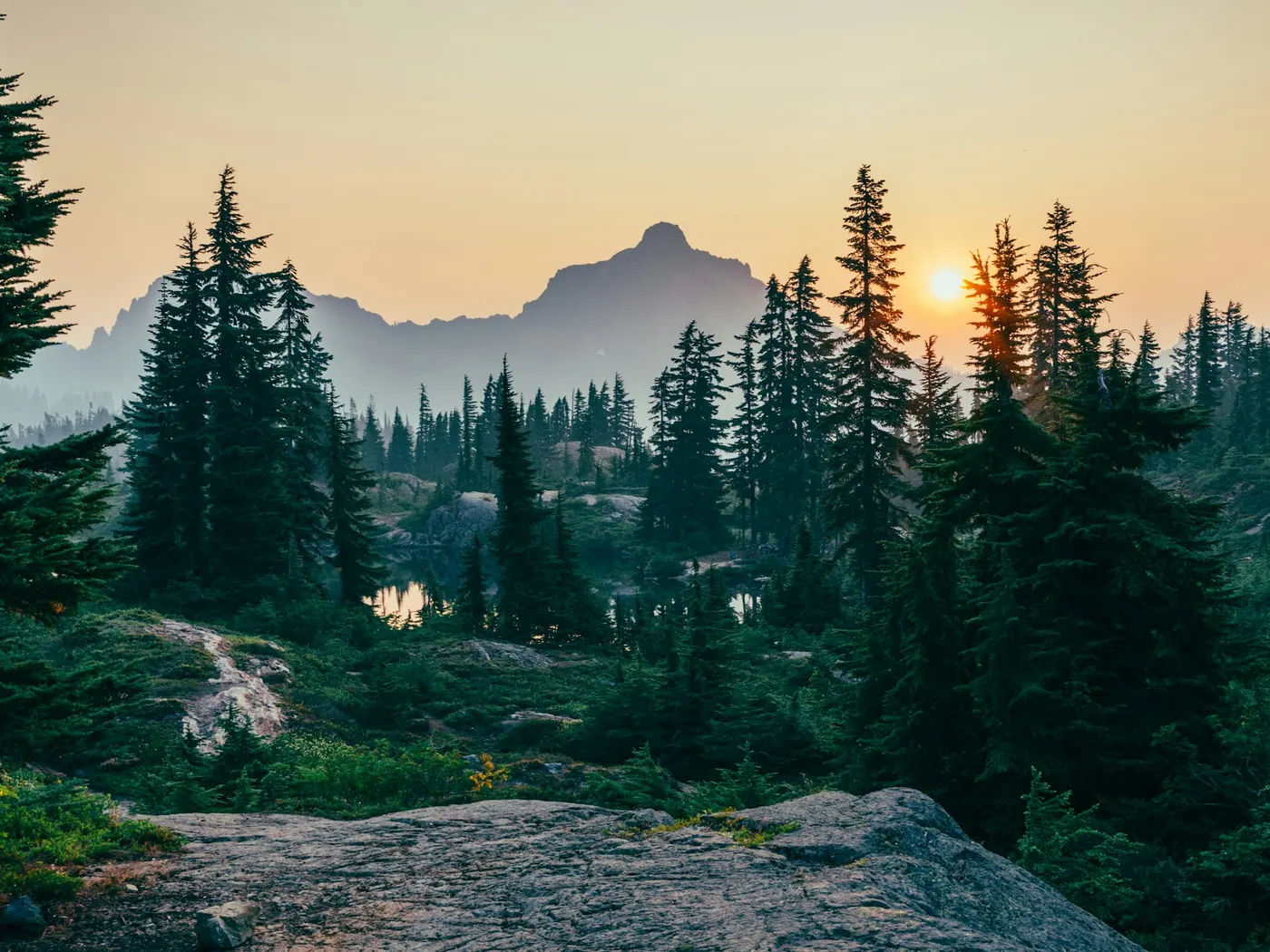
Hammersley Hole sits in Pennsylvania. Swimmers come for a natural day on the water without resort amenities. If you are an experienced hiker with solid map skills and a hunger for genuine solitude, this is one of Pennsylvania's most extraordinary destinations. The trail to Hammersley Hole immerses you in a living, breathing wilderness long before you reach the water. Dense forest canopy filters the light into shifting green patterns on the trail floor. The air smells of damp earth, moss, and cold creek water. Along the way, you cross two cable bridges and a private swinging bridge. Each crossing a small adventure in itself, the cables humming faintly under your weight as the water rushes below. The creek corridor is rich with biodiversity: listen for the calls of woodland birds and watch for wildlife along the banks. In autumn, the surrounding hillsides erupt in amber, crimson, and gold, making the hike itself as spectacular as the destination. On a warm summer afternoon, slipping into that pool after miles of steep trail feels like the most well-deserved reward imaginable. The cold shock of the water giving way to a deep, full-body relief. Because there are no facilities of any kind here, is purely elemental: you, the water, the forest, and the sound of the creek finding its way downstream. This is a true wilderness swim, unspoiled and unhurried. Swim at your own risk at Hammersley Hole. Check conditions after rain and respect any posted closures.
Key facts
Structured details for trip planning — verify access and fees with the land manager before you visit.
- Water type
- Creek
- Water body
- Hammersley Fork
- Fee
- Free
- Nearest town
- Williamsport
- State
- Pennsylvania
- Coordinates
- 41.32646, -77.75082
- Best season
- Late May to early September for optimal weather and warmer water temperatures. Autumn offers stunning foliage for photography enthusiasts.
- Access difficulty
- Strenuous. Requires a 12-mile round-trip hike on narrow, steep trails. Suitable for experienced hikers with good map skills.
- Parking
- Roadside / pull-off
- Restrooms
- Limited — see facilities notes
- Lifeguard
- None — assume unguarded
- Camping
- Nearby at Ole Bull S.P.
- Land manager
- State park / recreation agency
- Activities
- Hiking, Swimming
- Facilities
- No facilities at Hammersley Hole. Camping and amenities available at nearby Ole Bull State Park, including restrooms and picnic areas.
- Listing last updated
- May 12, 2026
The experience
- Best time to visitLate May to early September for optimal weather and warmer water temperatures. Autumn offers stunning foliage for photography enthusiasts.
- AccessStrenuous. Requires a 12-mile round-trip hike on narrow, steep trails. Suitable for experienced hikers with good map skills.
- FacilitiesNo facilities at Hammersley Hole. Camping and amenities available at nearby Ole Bull State Park, including restrooms and picnic areas.
- Camping nearbyNearby at Ole Bull S.P.
Highlights & features
- Secluded natural pool in Pennsylvania
- Challenging 12-mile hike to access
- Crystal-clear water with varying depths
- Rich biodiversity and scenic views
- Ideal for adventurous hikers and swimmers
- Remote location accessed via a challenging hike
- Unspoiled natural beauty and vibrant ecosystem
- Two cable bridges and a private swinging bridge along the trail
How to get there
Hammersley Hole lies in Pennsylvania near Williamsport, Lock Haven, and Redovo. Use these driving notes as a starting point and confirm road conditions before you go. Hammersley Hole is a remote . The hike to reach it is challenging and requires good map-reading skills. Please ensure you are prepared for a strenuous hike and take necessary precautions for wildlife, including rattlesnakes. A trail map is highly recommended. Driving Directions:
From Williamsport
Begin by heading west on Route 220 for about 25 miles to reach Lock Haven. From Lock Haven:
Take Route 120 northwest for about 30 miles. Continue past the town of Redovo until you reach Route 144. On Route 144
Turn north onto Route 144 and drive through Tamarack. Continue until Route 144 reaches a "T" intersection and turns right. At this intersection, set your odometer.
Continue on Route 144:
Turn right at the "T" intersection and drive about 1.75 miles. Look for a dirt road on your left (north) marked "Hammersley Fork Ave." Note: This turn is about 4.75 miles before you reach Cross Fork on Route 144.
Trailhead and Hiking Directions: Dirt Road Access
Turn onto Hammersley Fork Ave, which is a dirt road. There are two entrances to this road; only the northern entrance is open. The southern entrance crosses a small bridge marked "closed." Proceed north on the dirt road for about half a mile. This section of the road parallels Hammersley Fork Run and passes through private land before entering State Forest land. Stream Crossing
The dirt road fords the stream and is closed to vehicles. You can cross the stream via a two-cable footbridge or by foot. Once across, follow the road on the west side of the stream for about one mile. Bridge Crossings: As you hike, you will encounter a private swinging bridge and another cable bridge. These allow you to cross back to the east side of the creek. Follow the stream north until you reach County Line Run. Finding the Footpath: Look carefully along the base of the mountain for a narrow footpath that ascends a grade and runs parallel to Hammersley Fork along the mountainside. The footpath levels off before descending to Dump Hollow. If you miss the footpath earlier, you can connect with it here. Continuing the Hike: Follow the path through Dump Hollow and continue onward. The trail will lead you to Elkhorn Hollow. Stay on the path as it descends to stream level. After a short distance, you will arrive at Hammersley Pool. Important Notes: Hike Length: The round-trip hike is over 12 miles and traverses demanding terrain. The mountainside trail is narrow, with steep slopes. Only experienced hikers should attempt this route. Wildlife Warning:
Rattlesnakes have been spotted in the area. Exercise caution and remain alert. Trail Navigation
The footpaths are not well-marked, and Hammersley Fork branches into multiple tributaries upstream. A detailed trail map is essential for navigation.
Parking
Park near the entrance to the dirt road (Hammersley Fork Ave). Ensure your vehicle is not blocking access to private property or the road. Enjoy your hike and stay safe! Bring water, sunscreen, and gear for a primitive swim day. Weekends and holidays can draw more visitors. Check local updates on access and water levels before you leave home.
Plan your visit
Hammersley Hole works well as a day trip from Williamsport or Lock Haven. Stock up in town, then head to the water with food, water, and sun protection. Pair the swim with a stop at Ole Bull State Park (about 15 mi away) or browse more Pennsylvania creek spots in our directory. For the full list in Pennsylvania, see our state directory.
Access & fees
Access is via an unofficial, unmaintained route on state forest land. The hike is long and strenuous, with unmarked trails. The southern entrance to Hammersley Fork Ave is closed; use the northern entrance. Parking is limited to the roadside near the dirt road entrance without blocking access.
Frequently asked questions
Can you swim at Hammersley Hole?
Yes. Hammersley Hole near Williamsport, Lock Haven, and Redovo in PA is a creek swimming spot on Hammersley Fork. Scout depth and current before entering — no lifeguards at most natural access points.
Is Hammersley Hole free?
Access is generally free (fee listed as “None”). Confirm any parking or day-use rules on site, and pack out trash.
How do you get to Hammersley Hole?
Hammersley Hole is in PA within day-trip range of Williamsport, Lock Haven, and Redovo. Use a current map for the put-in or park entrance; cell service can be limited at remote spots.
Explore more nearby swimming guides
- Swimming holes near Lock Haven (21 mi)
- Swimming holes near State College (37 mi)
- Swimming holes near Wellsboro (37 mi)
- Pennsylvania swimming holes guide
- Swimming holes near Philadelphia
- Swimming holes near Pittsburgh
- More creek swimming holes
- Check water quality before swimming
- All Pennsylvania swimming holes
Nearby swimming holes
Map & location
Culture & history
The area reflects Pennsylvania’s rich history of outdoor recreation and conservation. Nearby towns like Lock Haven and Williamsport offer historical landmarks and cultural events.
Conservation
Visitors should follow Leave No Trace principles. Pack out all trash and respect the fragile ecosystem to preserve its natural beauty.
Sources & updates
Official land managers cited on this page
Always confirm current rules, closures, and fees on the agency site before visiting.
Reference sources
Spotted outdated access, fees, or safety info? Send a correction with the page URL — we review every submission.