
Laurel Fork
Swimming hole in Johnson City, Tennessee · Creek
Laurel Fork is a creek swimming hole. It is near Johnson City, Tennessee. Access is free. Best season: The best time to visit Laurel Fork is late spring through early fall (May to September) when the weather is warm, and the water is most inviting.
Typical season: The best time to visit Laurel Fork is late spring through early fall (May to September) when the weather is warm, and the water is most inviting
About Laurel Fork
Laurel Fork lies in Tennessee. Visitors trade crowds for a quieter bank access.
Fed by cool mountain springs and shaded by a dense canopy of hardwoods and hemlocks, the creek tumbles through a lush gorge carved over millennia. Delivering one of the most rewarding natural . This is an informal recreation area, which means no crowds, no snack bars, and no lifeguards.
What you get instead is something rarer: genuine wilderness solitude punctuated by the sound of rushing water and birdsong. Your approach to Laurel Fork follows a stretch of the Appalachian Trail, and the hike in sets the tone perfectly. The terrain is moderate but demands respect. Expect uneven footing, a few steep climbs, and a staircase descent toward the waterfall. As you descend into the gorge, the air grows noticeably cooler and carries that clean, mossy scent unique to Appalachian creek hollows. The forest here is dense and layered, sheltering rare plant species and a surprising variety of wildlife. In spring, wildflowers carpet the trail margins; by fall, the ridgelines above the gorge ignite in amber and crimson.
No lifeguards patrol Laurel Fork. Facilities are limited, so judge depth, current, and weather when you arrive.
Key facts
Structured details for trip planning — verify access and fees with the land manager before you visit.
- Water type
- Creek
- Water body
- Laurel Fork
- Fee
- Free
- Nearest town
- Johnson City
- State
- Tennessee
- Coordinates
- 36.27278, -82.13500
- Best season
- The best time to visit Laurel Fork is late spring through early fall (May to September) when the weather is warm, and the water is most inviting. Autumn is a strong choice for those seeking stunning foliage and cooler hiking conditions.
- Access difficulty
- Moderate. The hike to Laurel Fork involves uneven terrain, steep climbs, and a descent via stairs to the waterfall. Proper footwear and some hiking experience are recommended.
- Parking
- Designated area
- Lifeguard
- Present (seasonal)
- Camping
- Very pleasant camping nearby at Dennis Cove campground, which is further east on Dennis Cove Rd. Also at Garden's Bluff campground which is north of Hampton on RT 321.
- Activities
- Swimming
- Facilities
- There are no on-site facilities, so you should come prepared with their own food, water, and supplies. Camping is available nearby at Dennis Cove and Garden’s Bluff campgrounds.
- Last verified
- May 12, 2026
The experience
- Best time to visit The best time to visit Laurel Fork is late spring through early fall (May to September) when the weather is warm, and the water is most inviting. Autumn is a strong choice for those seeking stunning foliage and cooler hiking conditions.
- Access Moderate. The hike to Laurel Fork involves uneven terrain, steep climbs, and a descent via stairs to the waterfall. Proper footwear and some hiking experience are recommended.
- Facilities There are no on-site facilities, so you should come prepared with their own food, water, and supplies. Camping is available nearby at Dennis Cove and Garden’s Bluff campgrounds.
- Camping nearby Very pleasant camping nearby at Dennis Cove campground, which is further east on Dennis Cove Rd. Also at Garden's Bluff campground which is north of Hampton on RT 321.
Highlights & features
- Crystal-clear swimming spots along Laurel Fork
- Breathtaking Laurel Falls waterfall
- Shaded hiking trails in a lush gorge
- Seasonal beauty with vibrant foliage in fall
- Wildlife and unique plant species
- Swimming holes of varied depths
- Stunning waterfall backdrop
- Part of the iconic Appalachian Trail
How to get there
Laurel Fork lies in Tennessee near Johnson City, Elizabethton, and Hampton. Use these driving notes as a starting point and confirm road conditions before you go. Bring water, sunscreen, and gear for a primitive swim day. Weekends and holidays can draw more visitors. Check local updates on access and water levels before you leave home.
-
Driving Directions
From Johnson City: Begin your journey by heading northeast toward Elizabethton. Once in Elizabethton, follow Route 321 southeast toward Hampton. In Hampton: Look for signs directing you to the "Dennis Cove Recreation Area." Follow these signs to Dennis Cove Road. Continue east on Dennis Cove Road, which winds up the mountain for about 4, 5 miles. Keep an eye out for the point where Dennis Cove Road crosses the Appalachian Trail (AT). There will be a parking area on the left side of the road near an information sign. Important Note: If you reach the Dennis Cove Campground, you have gone too far. Turn around and return to the parking area near the Appalachian Trail crossing.
-
Parking Information
-
Parking near the Appalachian Trail can be limited, so plan accordingly. Arrive early to secure a spot. The parking area is adjacent to the trailhead and the information sign.
-
Hiking Directions to : Begin Your Hike
From the parking area, locate the Appalachian Trail trailhead behind the information sign. Begin hiking north on the AT, which follows a gorge along Laurel Fork Creek. The trail will lead you to several points of interest and . Landmarks and : Camping Area: Shortly after starting your hike, you’ll pass an informal camping area under tall pine trees on the right. There may be a .
-
Pond Mountain Wilderness Sign
Continue hiking until you see a sign for "Pond Mountain Wilderness." Just past this sign, down a steep bank, you’ll find a sandy area and a small . Footbridge: As you proceed, you’ll encounter a footbridge crossing the stream. There are .
-
Approaching Laurel Falls: Trail Sign
As you near Laurel Falls, you’ll see a sign indicating "Laurel Falls" and "High Water Route." Follow the Laurel Falls trail. Staircase to the Falls: Descend a steep staircase to reach Laurel Falls. At the base of the falls, there is a large pool. Exercise caution here, as currents can be strong, and the Forest Service advises against . Alternative : As you descend the stairs, just before reaching the bottom, you’ll notice a trail branching off to the right. Follow this trail downstream from the falls to find a large . Best : If you continue downstream along the creekside trail, the path will curve around the face of a rock bluff. Just as you round this bluff, you’ll discover a sandy-bottom . Additional Tips: Wear sturdy hiking shoes, as the trail includes steep sections and uneven terrain. Bring water and snacks, as the hike can take several hours depending on your pace and stops. Exercise caution when swimming, especially near the falls, as currents can be unpredictable. Respect the natural environment and pack out all trash to preserve the beauty of the area. Have a safe visit to Laurel Fork and Laurel Falls!
Plan your visit
Laurel Fork works well as a day trip from Johnson City or Elizabethton. Stock up in town, then head to the water with food, water, and sun protection. Combine the swim with camping at Chickamauga Creek or browse more Tennessee creek spots in our directory. For the full list in Tennessee, see our state directory.
Access & fees
Access is via a hike on the Appalachian Trail from a limited parking area near Dennis Cove. No fees or facilities are present. The swimming area is unofficial and not supervised.
Top picks for this trip
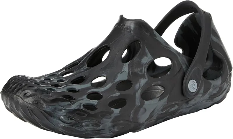
Merrell Hydro Moc
If you want one shoe that handles the walk in, the swim, and the lounge afterward, the Hydro Moc is the easiest pick.
Check price on
Rainleaf Microfiber Towel
Buy two — a large for drying off and a small for gear — and you still spend less than one cotton beach towel.
Check price onDisclosure: Gear links may earn a commission as an Amazon Associate — at no extra cost to you. Learn more.
What to pack for Laurel Fork
Gear we compare side by side for creek swims like this one — water access, sun, and the hike in.




Disclosure: Gear links may earn a commission as an Amazon Associate — at no extra cost to you. Learn more.
Frequently asked questions
Can you swim at Laurel Fork?
Yes. Laurel Fork near Johnson City, Elizabethton, and Hampton in TN is a creek swimming spot on Laurel Fork. Scout depth and current before entering — no lifeguards at most natural access points.
Is Laurel Fork free?
Access is generally free (fee listed as “No”). Confirm any parking or day-use rules on site, and pack out trash.
How do you get to Laurel Fork?
Laurel Fork is in TN within day-trip range of Johnson City, Elizabethton, and Hampton. Use a current map for the put-in or park entrance; cell service can be limited at remote spots.
Explore more nearby swimming guides
Nearby swimming holes
Map & location
Culture & history
Laurel Fork is near Elizabethton, a site of historical significance in early American governance. The region also intersects with the Appalachian Trail, a cultural symbol of exploration and adventure.
Conservation
Visitors should adhere to Leave No Trace principles, avoiding littering and minimizing their impact on the delicate ecosystem. Respect the area’s wildlife and plant life to help preserve its natural beauty.
Sources & updates
Spotted outdated access, fees, or safety info? Send a correction with the page URL — we review every submission.