North Santiam River Swimming Spots
Swimming hole in Salem, Oregon · River
North Santiam River Swimming Spots is a river swimming hole. It is near Salem, Oregon. Access is free. Best season: Late May to early September for warm water and sunny weather.
Typical season: Late May to early September for warm water and sunny weather
About North Santiam River Swimming Spots
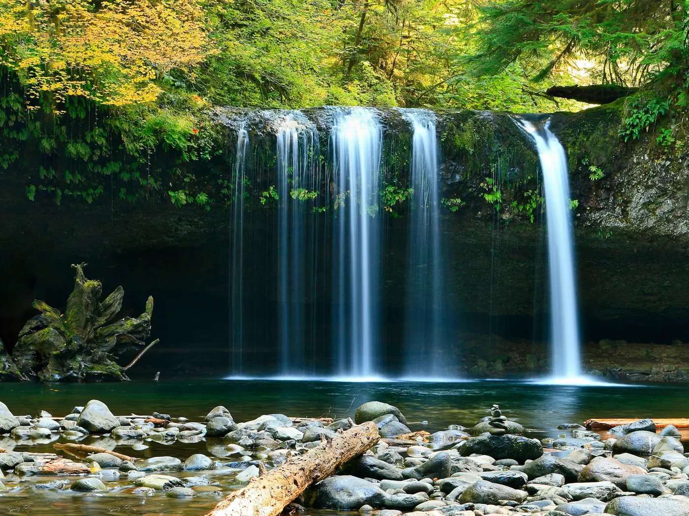
North Santiam River Swimming Spots gives you river swimming access near Salem in Oregon. Expect a natural bank, not a built beach. Towering Douglas firs and red alders shade the banks, their branches filtering afternoon sunlight into shifting patterns across the surface. This is a place where the air smells of pine needles and wet stone, and where the only soundtrack you need is moving water. Steep canyon walls softened by dense old-growth forest, narrow gravel beaches, and rocky outcroppings that beg to be jumped from the parking area. One of the most iconic spots along this corridor is near the historic Hannah Covered Bridge, where cultural heritage and natural beauty converge in a single, photogenic scene. Whether you're wading into a sun-warmed shallow run or slipping off a boulder into a deep, jade-green pool, the landscape rewards you at every turn. Wildflowers carpet the banks in spring, and come autumn, the hillsides erupt in amber and rust. Making shoulder-season visits genuinely spectacular even if the water is cooler. Some areas offer calm, deeper pools a strong choice for floating and swimming. No lifeguards patrol North Santiam River Swimming Spots. Facilities are limited, so judge depth, current, and weather when you arrive.
Key facts
Structured details for trip planning — verify access and fees with the land manager before you visit.
- Water type
- River
- Water body
- Varies - see below
- Fee
- Free
- Nearest town
- Salem
- State
- Oregon
- Coordinates
- 44.75210, -122.37839
- Best season
- Late May to early September for warm water and sunny weather; spring for wildflowers; autumn for vibrant foliage.
- Access difficulty
- Moderate; North Fork Park is easily accessible, while some remote spots may require hiking.
- Parking
- Designated area
- Lifeguard
- None — assume unguarded
- Camping
- There are several National Forest campgrounds along Little North Fork Road.
- Activities
- Swimming, Tubing
- Facilities
- Limited amenities; some locations have pit toilets, but you should bring your own supplies and water.
- Listing last updated
- May 12, 2026
The experience
- Best time to visitLate May to early September for warm water and sunny weather; spring for wildflowers; autumn for vibrant foliage.
- AccessModerate; North Fork Park is easily accessible, while some remote spots may require hiking.
- FacilitiesLimited amenities; some locations have pit toilets, but you should bring your own supplies and water.
- Camping nearbyThere are several National Forest campgrounds along Little North Fork Road.
Highlights & features
- Crystal-clear water
- Historic Hannah Covered Bridge
- Abundant wildlife
- Tubing opportunities
- Photographic landscapes
- Historic covered bridge swimming spot
- Diverse swimming holes along Little North Fork Santiam River
- Blend of cultural heritage and natural beauty
How to get there
North Santiam River Swimming Spots lies in Oregon near Salem, Mill City. Use these driving notes as a starting point and confirm road conditions before you go.
Hannah Covered Bridge )
Starting from Salem, take Route 22 (Santiam Highway) southeast for about 20 miles to the town of Mehama. At Mehama, turn onto Route 226 (Albany-Lyons Highway) heading south. Drive for about 10 miles. Turn left onto Camp Morrison Drive. Follow this road to reach the historic Hannah Covered Bridge. Important Notes:
Parking along the shoulder of the road near the bridge is strictly prohibited. Violators may be ticketed and towed.
Be aware that accessing this . Please respect all posted signs and local regulations.
Santiam River - Little North Fork
From Salem, take Route 22 (Santiam Highway) southeast for about 20 miles to Mehama.
At Mehama, turn left (northeast) onto North Fork Road, following signs for the Little Santiam Recreation Area. North Fork Road eventually becomes Forest Road 2207.
Set your odometer as you turn onto North Fork Road. Along this road, you will find multiple . Landmark
Drive about 2 miles from the turnoff onto North Fork Road. Look for a sign marking North Fork Park. This is one of the popular . Important Notes: Parking is available at designated areas near North Fork Park. Avoid blocking roadways or parking in undesignated spots. Exercise caution when swimming, as river currents can vary. Always supervise children and inexperienced swimmers. Have a safe visit to the North Santiam River ! Bring water, sunscreen, and gear for a primitive swim day. Weekends and holidays can draw more visitors. Check local updates on access and water levels before you leave home.
Plan your visit
North Santiam River Swimming Spots works well as a day trip from Salem or Mill City. Stock up in town, then head to the water with food, water, and sun protection. Pair the swim with a stop at Bagby Hot Springs And Swimming Area (about 16 mi away) or browse more Oregon river spots in our directory. For the full list in Oregon, see our state directory.
Access & fees
These are unofficial recreation sites. Parking is prohibited on road shoulders near the Hannah Covered Bridge; use designated areas only. Access to some spots, including the Hannah Covered Bridge area, involves crossing private property. always observe posted signs. Facilities are limited and vary by location.
Frequently asked questions
Can you swim at North Santiam River Swimming Spots?
Yes. North Santiam River Swimming Spots near Salem and Mill City in OR is a river swimming spot on Varies - see below. Scout depth and current before entering — no lifeguards at most natural access points.
Is North Santiam River Swimming Spots free?
Access is generally free (fee listed as “No”). Confirm any parking or day-use rules on site, and pack out trash.
How do you get to North Santiam River Swimming Spots?
North Santiam River Swimming Spots is in OR within day-trip range of Salem and Mill City. Use a current map for the put-in or park entrance; cell service can be limited at remote spots.
Explore more nearby swimming guides
Nearby swimming holes
Map & location
Culture & history
The Hannah Covered Bridge reflects Oregon’s architectural heritage; Mill City and Salem add regional charm and history.
Conservation
Respect parking rules and private property; practice Leave No Trace principles to preserve the area’s beauty.
Sources & updates
Reference sources
Spotted outdated access, fees, or safety info? Send a correction with the page URL — we review every submission.