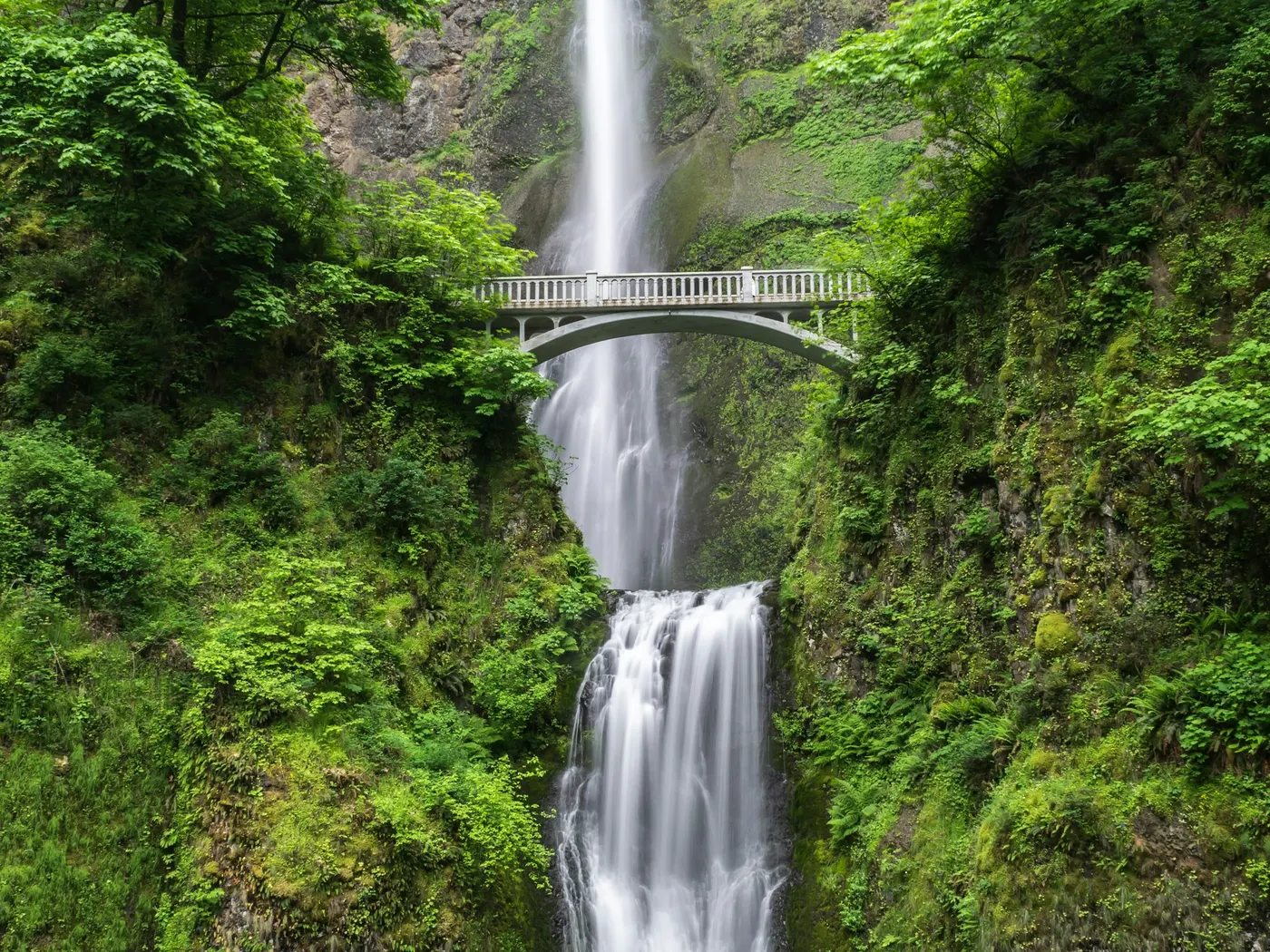
Big Laurel Falls
Swimming hole in Cashiers, North Carolina · Waterfall
Big Laurel Falls is a falls. swimming hole. It is at FR 67 Big Laurel Falls / Timber Ridge trailhead, Franklin, NC. Access is free. Best season: Weekday mornings May–September.
Typical season: Weekday mornings May–September
About Big Laurel Falls
Big Laurel Falls is a short Nantahala National Forest waterfall near Standing Indian Campground. about a **0.5-mile** hike from the FR 67 Timber Ridge / Big Laurel trailhead into a rhododendron cove where Big Laurel Branch spills into a cool plunge pool. It pairs easily with Mooney Falls roughly **0.7 mile** farther up the same forest road.
Access is free; the gravel approach past the Standing Indian fork is the real planning factor. The cove is small. perfect for a quiet swim when flow is moderate, miserable when ten carloads arrive at once. Cold water and slick rock are constant. The cove is tiny; if two groups are already swimming, continue to Mooney Falls and keep Big Laurel as a photo stop.
Key facts
Structured details for trip planning — verify access and fees with the land manager before you visit.
- Address
- FR 67 Big Laurel Falls / Timber Ridge trailhead, Franklin, NC 28734
- Water type
- Falls.
- Fee
- Free Nantahala National Forest trailhead access (no fee booth at Big Laurel Falls / FR 67 pullout)
- Nearest town
- Cashiers
- State
- North Carolina
- Coordinates
- 35.01825, -83.50637
- Best season
- Weekday mornings May–September
- Access difficulty
- Easy 0.5-mile hike after a gravel forest-road drive
- Parking
- Designated area
- Lifeguard
- Present (seasonal)
- Dogs allowed
- Yes
- Camping
- Standing Indian Campground / Nantahala NF camping
- Land manager
- U.S. Forest Service
- Activities
- Swimming, waterfall hike, photography, Mooney Falls add-on
- Facilities
- None at the falls; Standing Indian Campground nearby
- Last verified
- July 15, 2026
The experience
- Best time to visit Weekday mornings May, September
- Access Easy 0.5-mile hike after a gravel forest-road drive
- Facilities None at the falls; Standing Indian Campground nearby
- Camping nearby Standing Indian Campground / Nantahala NF camping
Highlights & features
- Scenic waterfall and natural pool
- Accessible 0.5-mile hike
- Located in Nantahala National Forest
- Seasonal beauty with wildlife and flora
- Ideal for swimming and photography
- Natural pool formed by cascading falls
- Located in a remote yet accessible part of Nantahala National Forest
- Rich biodiversity with wildlife and plant life
How to get there
Low-clearance cars usually manage dry gravel carefully.
-
From Franklin: US-64 west ~12 miles, left on West Old Murphy Road ~2 miles, right on FR 67 toward Standing Indian. At the campground fork (~1.7 mi) stay left on FR 67 gravel ~5.1 miles to the signed Big Laurel / Timber Ridge pullout (LAT 35.01825, LONG -83.50637).
-
1. Park in the small signed pullout — do not block FR 67.
-
2. Start downhill; at the T turn right, cross Mooney Creek on the bridge, then stay right on Big Laurel Falls Trail.
-
3. Reach the falls cove in about 0.5 mile; scout before swimming.
-
4. Optional: continue FR 67 ~0.7 mile to Mooney Falls trailhead.
Plan your visit
Big Laurel Falls works well as a day trip from Cashiers or Franklin. Stock up in town, then head to the water with food, water, and sun protection. Nearby options include Big Creek Smoky Mountains Swimming Spots and Big Laurel Creek Swimming Spots In Western North Carolina. For the full list in North Carolina, see our state directory.
Access & fees
Access is via Forest Road 67 (FR67), an unpaved forest service road. The parking area is unpaved but spacious. There are no known facilities or fees at the trailhead. Swimming is a noted activity, but water conditions and safety are not monitored.
Top picks for this trip

Rainleaf Microfiber Towel
Buy two — a large for drying off and a small for gear — and you still spend less than one cotton beach towel.
Check price on
ThinkSport Sport Mineral Sunscreen
The best blend of reef-safety, protection, and wearability — start here.
Check price onDisclosure: Gear links may earn a commission as an Amazon Associate — at no extra cost to you. Learn more.
What to pack for Big Laurel Falls
Gear we compare side by side for waterfall swims like this one — water access, sun, and the hike in.




Disclosure: Gear links may earn a commission as an Amazon Associate — at no extra cost to you. Learn more.
Frequently asked questions
How long is the Big Laurel Falls hike?
About 0.5 mile one-way (~1 mile round-trip) on an easy forest trail.
Is Big Laurel Falls free?
Yes — free trailhead parking on FR 67 with no ticket booth.
Can you swim at Big Laurel Falls?
Yes in the plunge pool when flow is moderate. No lifeguards; rocks are slick and water is cold.
Where is Big Laurel Falls near?
Nantahala National Forest near Franklin and the Standing Indian area, west of Cashiers.
Can you combine Mooney Falls?
Yes — Mooney Falls trailhead is about 0.7 mile farther on FR 67.
Do you need 4WD for FR 67?
Not usually in dry weather after the paved Standing Indian section, but gravel can be washboarded; turn around if ruts look bad.
Are dogs allowed?
Leashed dogs are typically allowed on Nantahala NF trails — pack out waste and keep pets off fragile cove banks.
When is Big Laurel Falls best?
Late spring–early fall on dry days; weekday mornings for solitude in the small cove.
Explore more nearby swimming guides
Nearby swimming holes
Map & location
Culture & history
Part of the Nantahala National Forest, historically significant to the Cherokee people. The name Nantahala means 'Land of the Noonday Sun.'
Conservation
Follow Leave No Trace principles: pack out trash, stay on trails, respect wildlife habitats, and avoid disturbing natural features.
Sources & updates
Official land managers cited on this page
Always confirm current rules, closures, and fees on the agency site before visiting.
Spotted outdated access, fees, or safety info? Send a correction with the page URL — we review every submission.