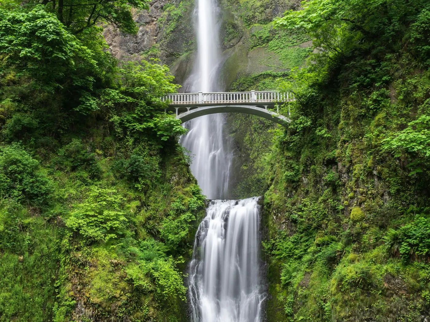
Big Sandy Creek Swimming Holes, West Virginia
Swimming hole in Morgantown, West Virginia · Waterfall
Big Sandy Creek Swimming Holes, West Virginia is a creeks /waterfall swimming hole. It is near Morgantown, West Virginia. Access is free. Best season: Late May to early September for optimal.
Typical season: Late May to early September for optimal
About Big Sandy Creek Swimming Holes, West Virginia
Big Sandy Creek Swimming Holes, West Virginia gives you creeks /waterfall swimming access near Morgantown in West Virginia. Expect a natural bank, not a built beach. Clustered near the historic Jenkinsburg Bridge where Big Sandy Creek spills into the Cheat River, this unofficial destination rewards those willing to earn it. With rough roads, a bit of hiking, and no hand-holding once you arrive. What you get in return is a stretch of creek so clear and untamed it feels like the modern world never found it. The star attraction is the Blue Hole , a wide, rocky . Downstream, Devil's Den earns its name with churning rapids and cliff-jump ledges that draw adrenaline seekers. Quieter souls gravitate toward Wonder Fall , a serene waterfall where the sound of rushing water drowns out everything else. Come spring, wildflowers push through the forest floor alongside the trail; in autumn, the hillsides ignite in amber and crimson, framing the Cheat River in a panoramic blaze of color. Seasonal wildlife. Herons, deer, and the occasional black bear at a respectful distance. Remind you that you're a guest here. The Swimming: Cold, Clear, and Completely Natural Big Sandy Creek runs clear and cold, fed by mountain headwaters that keep temperatures refreshing even on the hottest August afternoons. The Blue Hole offers depth and room to spread out across its rocky terrain, making it a strong choice for floating, diving, and simply cooling off. Devil's Den is for the bold. The rapids demand respect and the cliff jumps require a scout before you leap. Wonder Fall offers a gentler experience, where you can stand beneath the cascade and feel the cool mist on your face. There are no lifeguards, no ropes, and no guardrails. Treat Big Sandy Creek Swimming Holes, West Virginia as a wild swim: no lifeguard, variable depth, and rules that can change by season.
Key facts
Structured details for trip planning — verify access and fees with the land manager before you visit.
- Water type
- Creeks /Waterfall
- Water body
- Varies-see below
- Fee
- Free
- Nearest town
- Morgantown
- State
- West Virginia
- Coordinates
- 39.62125, -79.70115
- Best season
- Late May to early September for optimal .
- Access difficulty
- Moderate to challenging due to rugged trails and rough roads requiring high-clearance vehicles and some hiking.
- Parking
- Designated area
- Restrooms
- None on site
- Lifeguard
- None — assume unguarded
- Cliff jumping
- Not allowed
- Camping
- Camp near the bridge - no water or faculties. YOU MUST CLEAN UP AFTER YOURSELF OR WE WILL LOOSE THIS PLACE FOR SURE!
- Activities
- Swimming
- Facilities
- No amenities available. You should bring your own supplies and prepare for primitive camping near Jenkinsburg Bridge.
- Listing last updated
- May 12, 2026
The experience
- Best time to visitLate May to early September for optimal .
- AccessModerate to challenging due to rugged trails and rough roads requiring high-clearance vehicles and some hiking.
- FacilitiesNo amenities available. You should bring your own supplies and prepare for primitive camping near Jenkinsburg Bridge.
- Camping nearbyCamp near the bridge - no water or faculties. YOU MUST CLEAN UP AFTER YOURSELF OR WE WILL LOOSE THIS PLACE FOR SURE!
Highlights & features
- Blue Hole's expansive rocky terrain
- Devil’s Den rapids and cliff jumps
- Wonder Fall’s serene waterfall
- Cheat River panoramic views
- Seasonal wildlife and plant life
- Natural wilderness untouched by commercialization
- Diverse swimming experiences from waterfalls to rapids
- Historical significance of the Cheat River valley
How to get there
Big Sandy Creek Swimming Holes, West Virginia lies in West Virginia near Morgantown, Masontown. Use these driving notes as a starting point and confirm road conditions before you go. Big Sandy Creek ") Location:
Near Jenkinsburg Bridge, Cheat River Coordinates
Latitude: 39.5967, Longitude: -79.7447 Directions from Morgantown:
Begin by taking I-68 east and exit at
Exit 4 Merge onto Route 7 East and continue for about 12-15 miles to reach Masontown.
In Masontown, turn left at the Main Pharmacy onto Route 23 Drive for about 1 mile until you reach a large triangle-shaped intersection . At this intersection, follow the road left, heading toward Bull Run (look for the sign). Continue on County Road 21 (CR 21) for 4-5 miles until you reach a spot where three dirt roads meet near a small concrete bridge on your left. Do not turn left at the bridge ; instead, continue straight. The road will curve sharply to the right and become CR 14-4 Follow CR 14-4 , a dirt road, for several miles until you reach the Jenkinsburg Bridge over the Cheat River. Caution: This road is narrow, steep, and rocky, with limited space for passing or turning around. A high-clearance vehicle is required, and 4-wheel drive is strongly recommended. The last mile is particularly rough with loose rocks and an 80-foot drop-off on one side. Drive carefully.
Parking and Trail Access
After crossing the Jenkinsburg Bridge, you will find a large parking area immediately on the left for river access. This is not the Big Sandy . Continue past this parking area for a short distance until you reach the first sharp right turn . Look for a smaller parking area on the left side with rocks marked with Day-Glo orange paint. Park here and follow the trail a short distance. When you reach a large rock painted with "danger" in orange, take the short, steep downhill trail on the left to reach the river. The Blue Hole lies in Big Sandy Creek Important Notes: This . Do not jump off the Jenkinsburg Bridge into the Cheat River due to hidden rocks below. Please pack out all trash and help keep the area clean.
Primitive camping is available nearby. Devil’s Den Location
On the Cheat River, near Jenkinsburg Bridge Coordinates
Latitude: 39.59732, Longitude: -79.75040
Directions from Jenkinsburg Bridge
Before crossing the Jenkinsburg Bridge, look for a switchback road about 100 yards west of the bridge . This road follows the Cheat River north. The road is rough, so you may need to park and walk down the switchback. Follow the road for about 0.25 miles to reach Devil’s Den.
Devil’s Den lies directly on the Cheat River. You can swim in the rapids or cross to the cliffs for jumping. Caution
Do not swim during high water flows, as conditions can be dangerous. Wonder Falls Location
Big Sandy Creek, downstream from a waterfall Coordinates
Latitude: 39.6222, Longitude: -79.7047
Directions (Option 1 - From Jenkinsburg Bridge)
After crossing the Jenkinsburg Bridge, continue east on Route 14 for about 3.5 miles until you reach an intersection with Route 15 Stay on Route 14 by turning left at the intersection. Continue for another 1.5 miles , crossing a bridge over Big Sandy Creek. Park on the far side of the bridge.
Directions (Option 2 - From Morgantown)
Take I-68 east and exit at
Exit 15
Set your odometer and head east on County Road 73 , which parallels the interstate on the north side. Drive for about 3.2 miles to the village of Laurel Run. Turn right onto the gravel road ( Route 73, Laurel Run-Pisgah Road ) that goes under the interstate. Follow this road for 0.5 miles , then turn left onto **County Road 14-1 (George Walls Bring water, sunscreen, and gear for a primitive swim day. Weekends and holidays can draw more visitors. Check local updates on access and water levels before you leave home.
Plan your visit
Big Sandy Creek Swimming Holes, West Virginia works well as a day trip from Morgantown or Masontown. Stock up in town, then head to the water with food, water, and sun protection. Pair the swim with a stop at Deckers Creek Trail (about 7 mi away) or browse more West Virginia creek spots in our directory. For the full list in West Virginia, see our state directory.
Access & fees
Access is via steep, narrow, and rocky dirt roads (CR 14-4) requiring a high-clearance vehicle; 4WD is strongly recommended. Parking is limited to small, informal pull-offs. This is an unofficial, unsanctioned site with no amenities or management. Water depth and flow vary seasonally.
Frequently asked questions
Can you swim at Big Sandy Creek Swimming Holes, West Virginia?
Yes. Big Sandy Creek Swimming Holes, West Virginia near Morgantown and Masontown in WV is a creeks /waterfall swimming spot on Varies-see below. Scout depth and current before entering — no lifeguards at most natural access points.
Is Big Sandy Creek Swimming Holes, West Virginia free?
Access is generally free (fee listed as “No”). Confirm any parking or day-use rules on site, and pack out trash.
How do you get to Big Sandy Creek Swimming Holes, West Virginia?
Big Sandy Creek Swimming Holes, West Virginia is in WV within day-trip range of Morgantown and Masontown. Use a current map for the put-in or park entrance; cell service can be limited at remote spots.
Explore more nearby swimming guides
Nearby swimming holes
Map & location
Culture & history
Situated in the Appalachian region, the area reflects West Virginia’s heritage, including the Cheat River’s historic role in local industries.
Conservation
Follow Leave No Trace principles. Avoid littering and protect local wildlife and plant life to preserve the area’s natural beauty.
Sources & updates
Reference sources
Spotted outdated access, fees, or safety info? Send a correction with the page URL — we review every submission.