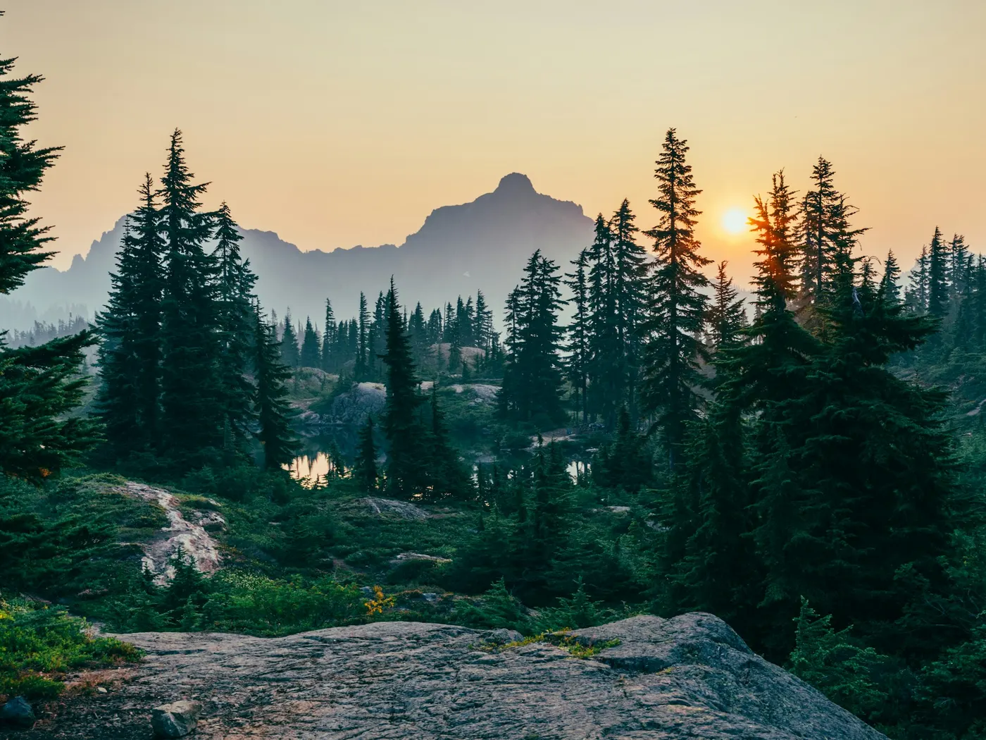
Grafton Region Swimming Holes
Swimming hole in Morgantown, West Virginia · Creek
Grafton Region Swimming Holes is a creek/river swimming hole. It is near Morgantown, West Virginia. Access is free. Best season: June through August for swimming, while spring offers vibrant wildflowers and autumn presents stunning foliage reflections.
Typical season: June through August for swimming, while spring offers vibrant wildflowers and autumn presents stunning foliage reflections
About Grafton Region Swimming Holes
Grafton Region Swimming Holes gives you creek/river swimming access near Morgantown in West Virginia. Expect a natural bank, not a built beach.
These are places where creek water runs cold and clear over ancient rock shelves, where hemlocks lean over the banks, and where the only soundtrack is moving water and birdsong.
If you're willing to navigate a few winding rural roads and embrace the spontaneity of an unsanctioned adventure, the payoff is extraordinary. Two spots stand out in this region: Fortney's Mill along Three Fork Creek and Arden Falls, both offering distinctly different but equally rewarding experiences. At Fortney's Mill, a picturesque waterfall tumbles over ledge rock into a deep, shadowed pool, and the star attraction. A natural sliding rock. Has been entertaining swimmers for generations. The creek corridor is lush and intimate, hemmed in by dense second-growth forest that keeps the air cool even on the hottest July afternoons. Arden Falls takes a more expansive character, with broad, sun-warmed flat rocks stretching out beside serene pools, a strong choice for lounging between swims. The Tygart River valley ties these spots together historically and geographically, and the surrounding countryside shifts beautifully through the seasons. Wildflower-dotted banks in spring, vivid green canopies in summer, and breathtaking amber and crimson foliage reflected in the water come autumn.
Swim at your own risk at Grafton Region Swimming Holes. Check conditions after rain and respect any posted closures.
Key facts
Structured details for trip planning — verify access and fees with the land manager before you visit.
- Water type
- Creek/River
- Water body
- Varies- See below
- Fee
- Free
- Nearest town
- Morgantown
- State
- West Virginia
- Best season
- June through August for swimming, while spring offers vibrant wildflowers and autumn presents stunning foliage reflections.
- Access difficulty
- Moderate: Fortney’s Mill requires careful navigation along Three Fork Creek with uncertain directions, while Arden Falls involves winding rural roads.
- Parking
- Roadside / pull-off
- Lifeguard
- Present (seasonal)
- Cliff jumping
- Reported
- Camping
- Nearby at Tygart Lake State Park.
- Land manager
- State park / recreation agency
- Activities
- Swimming, jumping
- Facilities
- Facilities are unknown, but camping and amenities are available at nearby Tygart Lake State Park.
- Last verified
- May 12, 2026
The experience
- Best time to visit June through August for swimming, while spring offers vibrant wildflowers and autumn presents stunning foliage reflections.
- Access Moderate: Fortney’s Mill requires careful navigation along Three Fork Creek with uncertain directions, while Arden Falls involves winding rural roads.
- Facilities Facilities are unknown, but camping and amenities are available at nearby Tygart Lake State Park.
- Camping nearby Nearby at Tygart Lake State Park.
Highlights & features
- Picturesque waterfall and sliding rock at Fortney’s Mill
- Expansive flat rocks and serene pools at Arden Falls
- Seasonal beauty with lush greenery and autumn foliage
- Opportunities for photography and wildlife observation
- Free access with nearby camping options
- Sliding rock at Fortney’s Mill
- Strong currents and secluded areas at Arden Falls
- Historical ties to the Tygart River and nearby towns
How to get there
Grafton Region Swimming Holes lies in West Virginia near Morgantown, Grafton, and Philippi. Use these driving notes as a starting point and confirm road conditions before you go. Location 1: Fortney’s Mill Fortney’s Mill is a popular . It features a small waterfall, a sliding rock, and is situated under a highway bridge. Please note that this area can be crowded, and you should wear foot protection to avoid broken glass. It is also recommended to bring a bag for trash removal to help keep the area clean. Bring water, sunscreen, and gear for a primitive swim day. Weekends and holidays can draw more visitors. Check local updates on access and water levels before you leave home.
-
Driving Directions from Grafton
-
Begin in Grafton and head east on Route 50 (US-50).
Continue on Route 50 until you reach Thornton. In Thornton, turn left onto Iron Town Road (County Road 7). Follow Iron Town Road north along Three Fork Creek. As you drive north along the creek, you will encounter several bridges crossing the creek. The .
-
Additional Notes
The exact location of the .420178 and longitude -79.883035. You can use this Google Maps link for precise navigation: http://maps.google.com/maps?&z=10&q=39.420178,-79.883035 . Parking is limited, so plan accordingly. Be mindful of private property and park in designated areas if available. Location 2: Arden Falls (Moats Falls) Arden Falls, also known as Moats Falls, is a popular . The area features large flat rocks for jumping and calm water for swimming. However, you should exercise caution as certain areas of the river have strong currents. Stay in calm sections and avoid drifting downstream. Safety is paramount.
-
Driving Directions from Grafton
-
Begin in Grafton and head south on Route 119 (Beverly-Fairmont Pike).
Continue on Route 119 through Webster. After Webster, turn left onto Arden Road (County Road 6). Follow Arden Road for about 3.5 miles. Be prepared for several twists and turns along the way. Turn right onto Laurel Creek Road (County Road 12). Proceed on Laurel Creek Road until you reach the bridge over the Tygart River at Arden.
-
Additional Notes
The . The general area coordinates are latitude 39.21044 and longitude -79.9937. You can use this Google Maps link for navigation: http://maps.google.com/maps?&z=10&q=39.21044,-79.9937 . Parking is available near the bridge, but spaces may be limited. Be mindful of private property and park responsibly. Exercise caution when . Have a safe visit to the Grafton Region !
Plan your visit
Grafton Region Swimming Holes works well as a day trip from Morgantown or Grafton. Stock up in town, then head to the water with food, water, and sun protection. Combine the swim with camping at Bemis Area or browse more West Virginia river spots in our directory. For the full list in West Virginia, see our state directory.
Access & fees
Both locations are unofficial, public land access points with no fee indicated. Facilities are unknown. Parking is limited. Always respect private property boundaries and park only in designated or legal pull-off areas to avoid trespassing.
Top picks for this trip
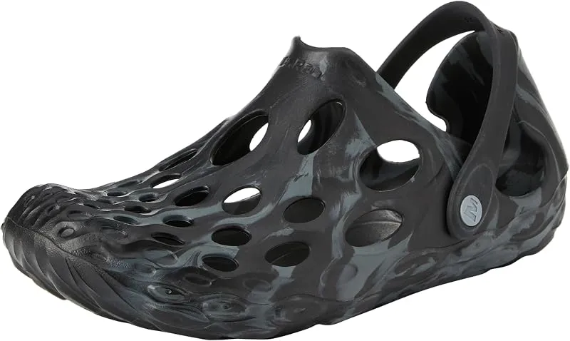
Merrell Hydro Moc
If you want one shoe that handles the walk in, the swim, and the lounge afterward, the Hydro Moc is the easiest pick.
Check price on
Rainleaf Microfiber Towel
Buy two — a large for drying off and a small for gear — and you still spend less than one cotton beach towel.
Check price onDisclosure: Gear links may earn a commission as an Amazon Associate — at no extra cost to you. Learn more.
What to pack for Grafton Region Swimming Holes
Gear we compare side by side for creek swims like this one — water access, sun, and the hike in.




Disclosure: Gear links may earn a commission as an Amazon Associate — at no extra cost to you. Learn more.
Frequently asked questions
Can you swim near Grafton WV?
Yes. The Grafton area has creek swimming holes including Fortney’s Mill-style sliding rock spots. Free informal access — no lifeguards.
Is Fortney Mill swimming free?
Yes. Informal access is typically free. Respect private land and pack out trash.
How do you get to Grafton swimming holes?
Around Grafton in north-central West Virginia. Use local maps for creek access; roadside parking is limited.
When is the best time to swim near Grafton?
Late spring through early fall. After rain, wait for creeks to drop before sliding or jumping.
Explore more nearby swimming guides
Nearby swimming holes
Culture & history
Grafton’s history as a Baltimore and Ohio Railroad hub adds a unique layer of significance, while the Tygart River reflects the region's industrial and natural heritage.
Conservation
Visitors should follow Leave No Trace principles by taking their trash, avoiding wildlife disturbance, and preserving the natural beauty of the swimming holes.
Sources & updates
Official land managers cited on this page
Always confirm current rules, closures, and fees on the agency site before visiting.
Spotted outdated access, fees, or safety info? Send a correction with the page URL — we review every submission.