Little River Canyon Swimming Holes
Swimming hole in Ft. Payne (al) (tn), Alabama · River
Little River Canyon Swimming Holes is a river swimming hole. It is near Ft. Payne (al) (tn), Alabama. Access is free. Best season: summer (June to August) for optimal.
Typical season: summer (June to August) for optimal
About Little River Canyon Swimming Holes
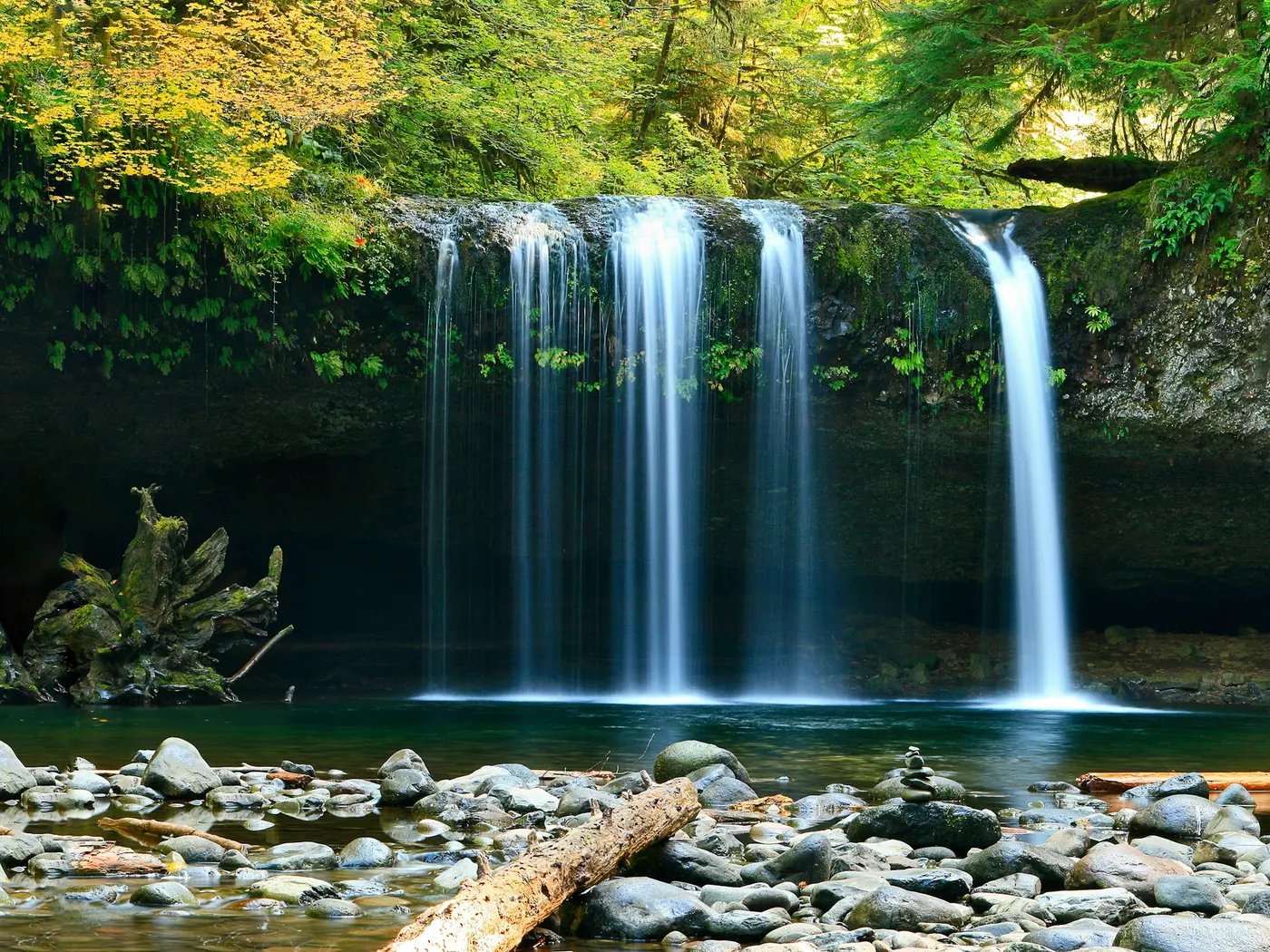
Little River Canyon Swimming Holes lies in Alabama. Visitors trade crowds for a quieter bank access. Little River is famously one of the few rivers in North America that flows almost entirely atop a mountain. Lookout Mountain. Carving a dramatic sandstone canyon that plunges over 600 feet in places. Standing at the canyon rim, you immediately understand why people make the drive. Sheer sandstone walls, draped in ferns and mosses, drop away into a river corridor thick with hemlocks, mountain laurel, and hardwoods. In summer, the canopy keeps the canyon floor pleasantly cool even when temperatures on the plateau above push into the nineties. The river itself runs clear and cool over smooth-worn boulders, pooling in pockets of jade-green water that invite you to linger. At Little River Falls. The preserve's iconic entry point. A broad curtain of whitewater crashes into a churning pool with a mist that you can feel from twenty feet away. Further downstream, the atmosphere grows quieter and wilder with each mile. The Upper Hole near Little River Falls is family-friendly. The water is relatively shallow in places, the current manageable, and the surroundings are stunning without demanding much effort to reach. Treat Little River Canyon Swimming Holes as a wild swim: no lifeguard, variable depth, and rules that can change by season.
Key facts
Structured details for trip planning — verify access and fees with the land manager before you visit.
- Water type
- River
- Water body
- Little River
- Fee
- Free
- Nearest town
- Ft. Payne (al) (tn)
- State
- Alabama
- Coordinates
- 34.28814, -85.68161
- Best season
- summer (June to August) for optimal . Spring (April to May) offers lush scenery but higher water levels, while fall (September to November) provides stunning foliage and cooler weather.
- Access difficulty
- Varies by location: Easy access at Little River Falls and Upper Hole; moderate hikes to Martha’s Falls; steep and challenging descent to Lower Two Mile.
- Parking
- Designated area
- Restrooms
- Yes
- Lifeguard
- None — assume unguarded
- Cliff jumping
- Reported
- Camping
- Nearby at Desoto S.P. (205)845-5075
- Land manager
- National Park Service
- Activities
- Swimming
- Facilities
- Toilets are available at Little River Falls and Canyon Mouth Park. No fees are required for entry, and camping is nearby at DeSoto State Park.
- Listing last updated
- May 12, 2026
The experience
- Best time to visitsummer (June to August) for optimal . Spring (April to May) offers lush scenery but higher water levels, while fall (September to November) provides stunning foliage and cooler weather.
- AccessVaries by location: Easy access at Little River Falls and Upper Hole; moderate hikes to Martha’s Falls; steep and challenging descent to Lower Two Mile.
- FacilitiesToilets are available at Little River Falls and Canyon Mouth Park. No fees are required for entry, and camping is nearby at DeSoto State Park.
- Camping nearbyNearby at Desoto S.P. (205)845-5075
Highlights & features
- Six diverse swimming spots
- Historic Little River Falls
- Thrilling cliff-jumping at Martha’s Falls
- Family-friendly Upper Hole
- Secluded Lower Two Mile
- Diverse swimming experiences from shallow pools to cliff-jumping
- Geological marvels carved by Little River
- Rich historical and cultural significance
How to get there
Little River Canyon Swimming Holes lies in Alabama near Chattanooga (Tn), Ft. Payne (Al) (Tn). Use these driving notes as a starting point and confirm road conditions before you go.
General Driving Directions
From Gadsden, take Interstate 59 northeast for about 35 miles to Fort Payne. Once in Fort Payne, follow Route 35 east and look for signs directing you to Little River Canyon.
1. Little River Falls Driving Directions:
From Route 35, park at the designated falls parking area. Trail Details
Follow the paved walkway from the parking lot until you reach a well-traveled trail on the left. This trail leads to the bottom of the falls. For families with children, you can access shallow water areas by walking up the river from the main parking lot at a safe distance from the falls. Alternatively, from the overflow parking lot across the road, follow the signs marked "To Falls." Under the bridge is a shallow area suitable for play. Coordinates: Latitude: 34.3950, Longitude: -85.627 Google Maps Link: Click here
2. Martha’s Falls (Hippie Hole) Driving Directions
From the Little River Falls parking area, turn right onto Route 35. Shortly up the road, you’ll find a gravel parking area on the right. Trail Details: Park in the gravel lot and follow the gravel trail for about 1/4 mile. The trail transitions into a rock path that leads to the water. The hike back out is steep and may be challenging. Martha’s Falls offers excellent . High water levels can be dangerous, so exercise caution. This location is not recommended for children under 10 due to the steep hike and jumping areas. Coordinates: Latitude: 34.38942, Longitude: -85.62139 Google Maps Link: Click here 3. Upper Hole Driving Directions: From the Little River Falls main parking area, turn right onto Route 35 and drive about 0.5 miles. Look for a dirt road on the left that cuts back sharply. Follow this dirt road for about 200 yards to a small parking area at the dead end. Trail Details: The river is accessible directly from the parking area. This spot features a rope swing and shallow pools, making it a strong choice for families with young children or those who prefer minimal hiking. During late summer, low water levels create shallow pools above the main falls, perfect for children to splash and play. Coordinates: Latitude: 34.395306, Longitude: -85.621186 Google Maps Link: Click here 4. Lower Two Mile Driving Directions: From the northern end of the Canyon Rim Parkway (Route 176), drive about 3.1 miles. Look for a small pullout with a sign marked "Lower Two Mile." The pullout is partially hidden due to a sharp curve in the road, so proceed carefully. Trail Details: The trail begins at the sign and is steep and primitive, taking about 30 minutes to descend. The climb back up is strenuous. At the river, you’ll find a large, deep . This location is secluded and may be less crowded. Coordinates: Latitude: 34.36397, Longitude: -85.65264 Google Maps Link: Click here 5. Eberhart Point Driving Directions: From the southern end of the Canyon Rim Parkway (Route 176), drive a few miles until you see a major pullout with a sign marked "Eberhart Point." Trail Details: A trail begins at the pullout and descends to the river. The river below offers Bring water, sunscreen, and gear for a primitive swim day. Weekends and holidays can draw more visitors. Check local updates on access and water levels before you leave home.
Plan your visit
Little River Canyon Swimming Holes works well as a day trip from Chattanooga (Tn) or Ft. Payne (Al) (Tn). Stock up in town, then head to the water with food, water, and sun protection. Pair the swim with a stop at Desoto Lookout Mountain Swimming Destinations (about 15 mi away) or browse more Alabama river spots in our directory. For the full list in Alabama, see our state directory.
Access & fees
Access to these swimming holes is via unofficial, often unmarked trails. Parking is limited at some locations. There is no fee for entry. Toilets are available only at the main Little River Falls parking area and Canyon Mouth Park; plan accordingly. The area is managed by the National Park Service, and all standard park regulations apply.
Frequently asked questions
Can you swim at Little River Canyon Swimming Holes?
Yes. Little River Canyon Swimming Holes near Chattanooga (Tn) and Ft. Payne (Al) (Tn) in AL is a river swimming spot on Little River. Scout depth and current before entering — no lifeguards at most natural access points.
Is Little River Canyon Swimming Holes free?
Access is generally free (fee listed as “None”). Confirm any parking or day-use rules on site, and pack out trash.
How do you get to Little River Canyon Swimming Holes?
Little River Canyon Swimming Holes is in AL within day-trip range of Chattanooga (Tn) and Ft. Payne (Al) (Tn). Use a current map for the put-in or park entrance; cell service can be limited at remote spots.
Explore more nearby swimming guides
Nearby swimming holes
Map & location
Culture & history
The area holds historical significance as a sacred site for Native Americans and a key feature in Alabama’s natural heritage.
Conservation
Visitors are encouraged to follow Leave No Trace principles to protect the fragile ecosystem. Avoid littering and respect wildlife habitats.
Sources & updates
Official land managers cited on this page
Always confirm current rules, closures, and fees on the agency site before visiting.
Reference sources
Spotted outdated access, fees, or safety info? Send a correction with the page URL — we review every submission.