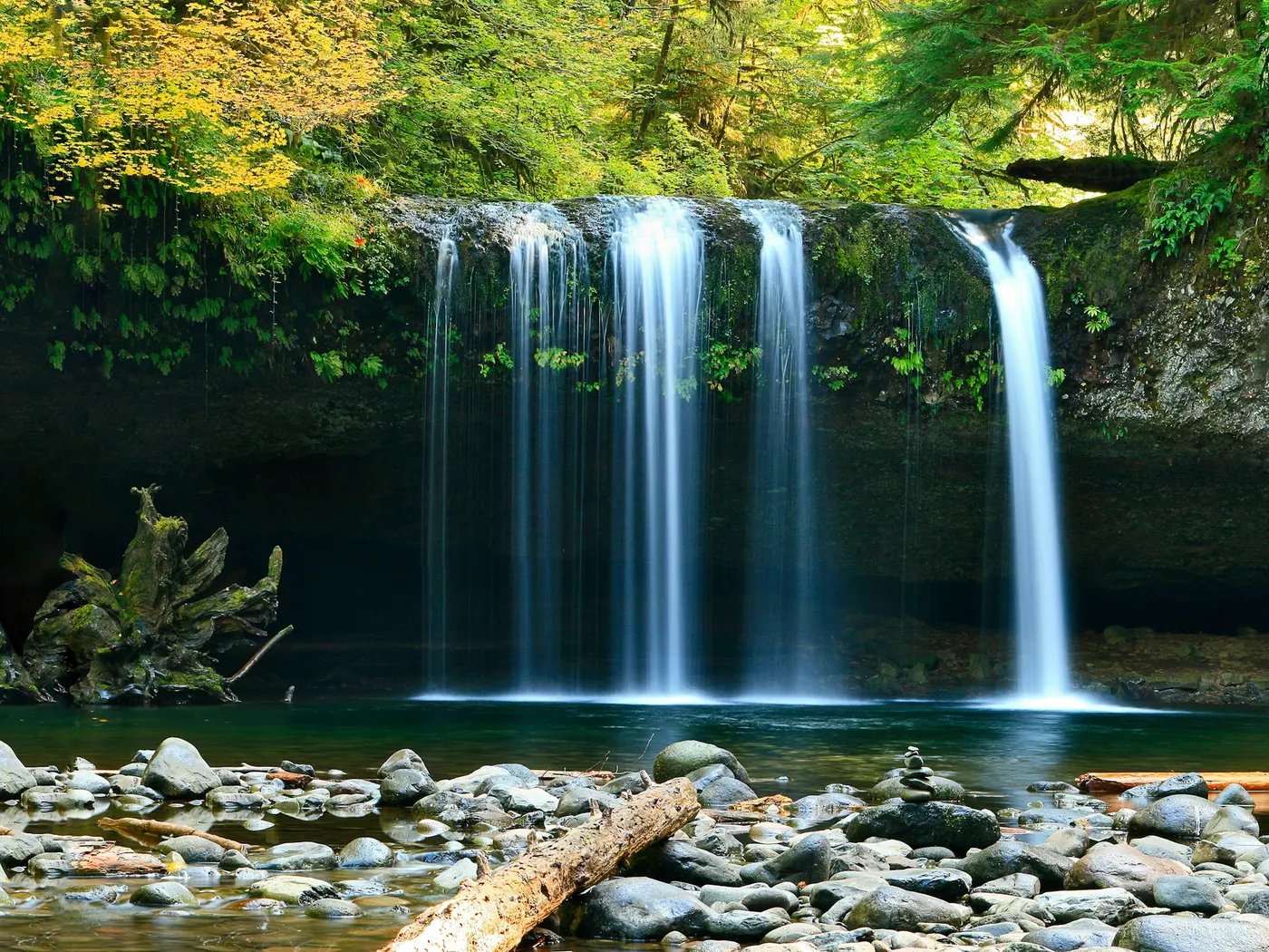
South Toe River
Swimming hole in Asheville, North Carolina · River
The South Toe River (also searched as the Toe River) below Mount Mitchell near Burnsville and Celo, North Carolina, has cold mountain-river swimming holes. Informal access is common around the Carolina Hemlocks / Black Mountain Campground corridor. Check flow after storms and any USFS or campground parking fees.
Typical season: Summer months (June to August) for swimming
About Mount Mitchell South Toe River Swimming Holes
Mount Mitchell South Toe River Swimming Holes is a River swimming destination near Asheville in North Carolina. The setting stays informal and low-key. Fed by snowmelt and rainfall trickling down the flanks of Mount Mitchell. The tallest peak east of the Mississippi. This stretch of river, historically known as the Estatoe River, runs cold, clear, and alive with the kind of energy that makes you forget whatever you drove away from the parking area. The scenery here earns its reputation. Hardwood forest presses close to the riverbanks, canopying the water in dappled green light during summer and erupting into fiery amber and crimson come fall. Smooth river stones line the banks and the streambed, worn soft by centuries of current. Deep pools form naturally between boulder outcroppings, their water so transparent you can count the pebbles on the bottom from the surface. The air smells of pine, cold water, and damp earth. A combination that feels immediately restorative. The name Estatoe carries the memory of the Native American people who called this watershed home, and that history adds a quiet depth to an already extraordinary place. Swimming, Jumping, and Tubing You'll find the South Toe River is perfectly suited to a leisurely, active afternoon. Swim at your own risk at Mount Mitchell South Toe River Swimming Holes. Check conditions after rain and respect any posted closures.
Key facts
Structured details for trip planning — verify access and fees with the land manager before you visit.
- Water type
- River
- Water body
- South Toe River (Estatoe River)
- Fee
- Fee required
- Nearest town
- Asheville
- State
- North Carolina
- Coordinates
- 35.91722, -82.29967
- Best season
- Summer months (June to August) for swimming.
- Access difficulty
- Easy to moderate; accessible by car with a short walk from parking areas. Suitable for families and casual hikers.
- Parking
- Designated area
- Restrooms
- Yes
- Lifeguard
- None — assume unguarded
- Cliff jumping
- Reported
- Camping
- Camping at sites
- Activities
- Swimming, Jumping, Tubing
- Facilities
- Amenities include toilets, changing rooms, picnic tables, and nearby camping sites. Entry fees help maintain these facilities and support conservation efforts.
- Listing last updated
- May 12, 2026
The experience
- Best time to visitSummer months (June to August) for swimming.
- AccessEasy to moderate; accessible by car with a short walk from parking areas. Suitable for families and casual hikers.
- FacilitiesAmenities include toilets, changing rooms, picnic tables, and nearby camping sites. Entry fees help maintain these facilities and support conservation efforts.
- Camping nearbyCamping at sites
Highlights & features
- Crystal-clear water for swimming
- Tubing-friendly gentle currents
- Rich cultural history tied to Native American tribes
- Seasonal beauty with fall foliage
- Camping and picnic facilities nearby
- Historical ties to the Estatoe people
- Located near Mount Mitchell, the tallest peak east of the Mississippi
- A blend of recreation and biodiversity
How to get there
Mount Mitchell South Toe River Swimming Holes lies in North Carolina near Asheville, Marion, and Celo. Use these driving notes as a starting point and confirm road conditions before you go.
The Mount Mitchell South Toe River . Use these driving notes to reach the
Step 1: Starting from the Blue Ridge Parkway Navigate to milepost 345 on the Blue Ridge Parkway. This is near the intersection with NC Route 80
Exit the Parkway and turn onto NC Route 80 North
Step 2: Follow NC Route 80 North
Drive north on NC Route 80 for about 12 miles You will pass through scenic areas, including forested landscapes and mountain views. Look for signs for the South Toe River or Black Mountain Campground as landmarks.
Step 3: Turn onto South Toe River Road
After about 12 miles, turn onto South Toe River Road (also known as Forest Service Road 472 ) near the entrance to the Black Mountain Campground Follow South Toe River Road for about 1 mile
Step 4: Parking and Trail Access
Look for parking areas near the Black Mountain Campground . There is designated parking available for visitors accessing the swimming area. Once parked, locate the trailhead leading to the South Toe River . Trails are well-marked and typically lead directly to the river.
Helpful notes
Wear sturdy shoes, as trails may have uneven terrain. Bring water and snacks, as amenities are limited in this area. Be mindful of local regulations and practice Leave No Trace principles to preserve the natural beauty of the area. Have a safe visit to the Mount Mitchell South Toe River ! Bring water, sunscreen, and gear for a primitive swim day. Weekends and holidays can draw more visitors. Check local updates on access and water levels before you leave home.
Plan your visit
Mount Mitchell South Toe River Swimming Holes works well as a day trip from Asheville or Marion. Stock up in town, then head to the water with food, water, and sun protection. Pair the swim with a stop at Rock Creek (about 15 mi away) or browse more North Carolina river spots in our directory. For the full list in North Carolina, see our state directory.
Access & fees
Access is via Forest Service roads near Black Mountain Campground. A fee is required. Facilities include toilets, changing rooms, and picnic tables. The area is managed and sanctioned for recreation. Parking is designated but can fill quickly on summer weekends.
Frequently asked questions
Where can you swim in the Toe River NC?
The South Toe River below Mount Mitchell near Burnsville and Celo has cold pools used by swimmers and tubers. Access is informal — stay on public forest or campground frontage and respect private land.
Is the South Toe River free?
Some pull-offs are free forest access; developed sites around Carolina Hemlocks / Black Mountain Campground can charge parking or camping fees. Confirm before you go.
How cold is the South Toe River?
It is a high-elevation mountain river — expect cold water even in July. After storms, flow and turbidity rise fast; skip jumping until you can see the bottom.
Can you swim at Mount Mitchell South Toe River Swimming Holes?
Yes. Mount Mitchell South Toe River Swimming Holes near Asheville, Marion, and Celo in NC is a river swimming spot on South Toe River (Estatoe River). Scout depth and current before entering — no lifeguards at most natural access points.
How much does Mount Mitchell South Toe River Swimming Holes cost?
Plan for fees: Yes. Rates and policies change — verify with the land manager before you drive.
How do you get to Mount Mitchell South Toe River Swimming Holes?
Mount Mitchell South Toe River Swimming Holes is in NC within day-trip range of Asheville, Marion, and Celo. Use a current map for the put-in or park entrance; cell service can be limited at remote spots.
Explore more nearby swimming guides
- Swimming holes near Asheville (26 mi)
- Swimming holes near Boone (41 mi)
- Swimming holes near Hickory (55 mi)
- North Carolina swimming holes guide
- Swimming holes near Asheville
- Swimming holes near Charlotte
- Swimming holes near Boone
- Swimming holes near Raleigh
- More river swimming holes
- Check water quality before swimming
- All North Carolina swimming holes
Nearby swimming holes
Map & location
Culture & history
The South Toe River, historically known as the Estatoe River, carries the legacy of the Native American Estatoe tribe. The area’s proximity to Mount Mitchell also holds significance, as it’s named after Elisha Mitchell, a geologist who studied the Appalachian Mountains.
Conservation
Follow Leave No Trace principles to protect the river and surrounding ecosystem. Avoid disturbing wildlife and stick to designated trails.
Sources & updates
Reference sources
Spotted outdated access, fees, or safety info? Send a correction with the page URL — we review every submission.