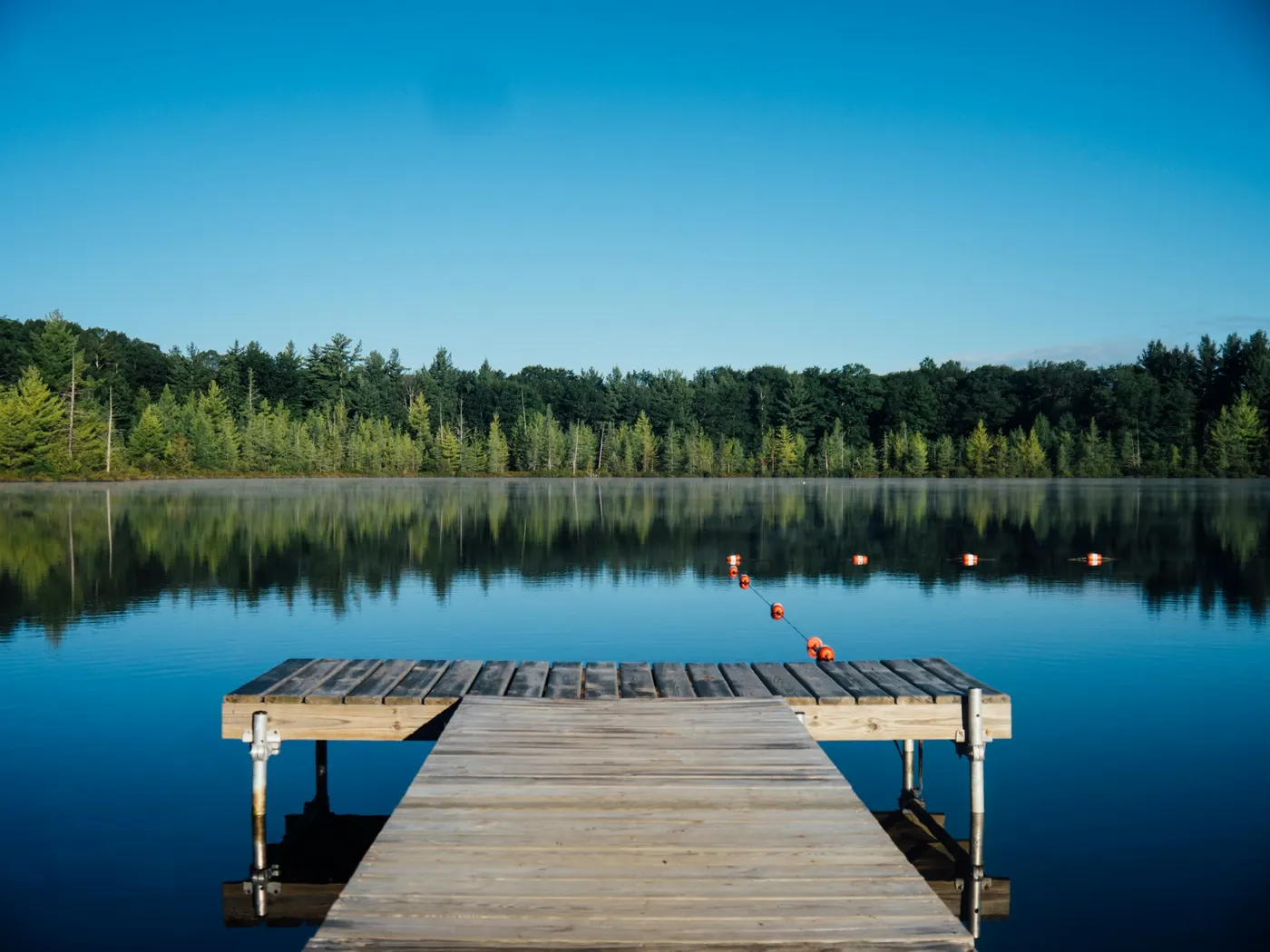
Smoky Mountain South Swimming Holes - Knoxville, Maryville, Chilhowee
Swimming hole in Knoxville, Tennessee · Other
Smoky Mountain South Swimming Holes - Knoxville, Maryville, Chilhowee is a natural swimming hole. It is near Knoxville, Tennessee. Access is free. Best season: Summer for swimming and warm-weather visits.
Typical season: Summer for swimming and warm-weather visits
About Smoky Mountain South Swimming Holes - Knoxville, Maryville, Chilhowee
Smoky Mountain South Swimming Holes - Knoxville, Maryville, Chilhowee is a Varies, See Below swimming destination near Knoxville in Tennessee. The setting stays informal and low-key. Accessible from Knoxville, Maryville, and Chilhowee, these unofficial spots range from easy roadside dips to remote backcountry rewards, strung together by the creeks and cascades that carve through one of America's most biodiverse landscapes. Every spot in this guide has its own personality, but all of them share the Southern Appalachian character: moss-covered boulders, dappled light filtering through a dense forest canopy, and the kind of quiet that reminds you how loud everyday life actually is. Abrams Creek offers the most accessible experience, with a deep . A strong choice for families or anyone who just wants to wade in quickly and let the afternoon unfold. The Little Bottoms trail leads you deeper into the forest, rewarding a moderate hike with secluded . And for those willing to earn it, the 7-mile trek to Wildcat Falls delivers a cascade experience unlike anything else in the region. Three separate waterfalls tumbling in sequence, with crystal-clear pools catching the light in ways that make photographers linger far longer than planned. Abrams Creek's main pool runs deep enough for confident swimmers to fully submerge and float, while the swimming area. Some gentle and wide, others tucked beneath rock overhangs where the air stays cool even on the hottest July afternoon. Spring brings an explosion of wildflowers and vivid green along every trail. Autumn transforms the hillsides into a patchwork of orange, crimson, and gold, making even a cool-water swim feel like a luxury. Swim at your own risk at Smoky Mountain South Swimming Holes - Knoxville, Maryville, Chilhowee. Check conditions after rain and respect any posted closures.
Key facts
Structured details for trip planning — verify access and fees with the land manager before you visit.
- Water type
- Varies, see below
- Water body
- Varies, see below
- Fee
- Free
- Nearest town
- Knoxville
- State
- Tennessee
- Coordinates
- 35.60957, -83.93536
- Best season
- Summer for swimming and warm-weather visits.
- Access difficulty
- Easy access at Abrams Creek Campground; Moderate hiking required for Little Bottoms trail; Challenging 7-mile hike to Wildcat Falls.
- Parking
- Roadside / pull-off
- Restrooms
- None on site
- Lifeguard
- None — assume unguarded
- Camping
- At Look Rock campground on Foothills Parkway (tends to be less crowded). Also established camping nearby at Abrams Creek, a National Park campsite (small, fills up often). Cherokee N.F. Is also nearby and has camping
- Activities
- Swimming
- Facilities
- No facilities available at the site. Nearby camping options include Abrams Creek Campground and Look Rock Campground.
- Listing last updated
- May 12, 2026
The experience
- Best time to visitSummer for swimming and warm-weather visits.
- AccessEasy access at Abrams Creek Campground; Moderate hiking required for Little Bottoms trail; Challenging 7-mile hike to Wildcat Falls.
- FacilitiesNo facilities available at the site. Nearby camping options include Abrams Creek Campground and Look Rock Campground.
- Camping nearbyAt Look Rock campground on Foothills Parkway (tends to be less crowded). Also established camping nearby at Abrams Creek, a National Park campsite (small, fills up often). Cherokee N.F. Is also nearby and has camping
Highlights & features
- Abrams Creek’s accessible deep pool
- Little Bottoms trail’s secluded swimming holes
- Wildcat Falls’ cascading waterfalls
- Abundant wildlife and flora
- Seasonal beauty and diverse experiences
- Three waterfalls at Wildcat Falls
- Primitive camping along Little Bottoms trail
- Crystal-clear water ideal for photography
How to get there
Smoky Mountain South Swimming Holes - Knoxville, Maryville, Chilhowee lies in Tennessee near Knoxville, Maryville, and Chilhowee. Use these driving notes as a starting point and confirm road conditions before you go. Smoky Mountain South Abrams Creek Campground
From Knoxville
Take Route 129 south through Maryville and Tallassee to Chilhowee.
From Chilhowee Continue east on Route 129, then turn northeast (left) onto Happy Valley Road. Follow this road until you see signs for Abrams Creek Campground.
Parking
Park at the campground entrance near the information sign. Note that only campers’ vehicles are allowed past this point.
Final Approach
Walk past the entrance sign along the road. Shortly after, you’ll find a deep, easily accessible . Coordinates Latitude: 35.60957, Longitude: -83.93536 (use Google Maps for precise navigation: http://maps.google.com/maps?&z=10&q=35.60957,-83.93536+\ ()). Little Bottoms Trail From Knoxville Follow Route 129 south through Maryville and Tallassee to Chilhowee. From Chilhowee Continue east on Route 129, then turn northeast (left) onto Happy Valley Road. Follow this road to Abrams Creek Campground. Trail Information The Little Bottoms Trail connects Abrams Falls with Abrams Creek Campground and follows Abrams Creek. The trail is about 5 miles each way. About halfway between Abrams Falls and Abrams Creek Campground, there is a large, primitive backpacker’s camp area beside Abrams Creek. Several good-sized . Coordinates Latitude: 35.6154, Longitude: -83.9115 (use Google Maps for general navigation: http://maps.google.com/maps?&z=10&q=35.6154,-83.9115+\ ()). Important Notes This area is primitive with no facilities or vehicle access. Be prepared for a moderate hike. Wildcat Falls Option 1: Route via Chilhowee From Knoxville
Take Route 129 south through Maryville and Tallassee to Chilhowee.
From Chilhowee Continue east on Route 129 until it makes a sharp left turn near the Cheoah Dam. Trailhead Access Near this sharp turn, locate Forest Trail #42. Follow this trail along the Tennessee River and up Slickrock Creek to Wildcat Falls. Hiking Details The hike is about 7 miles each way. Be prepared for a strenuous trek. Coordinates Latitude: 35.4274, Longitude: -83.9993 (use Google Maps for approximate navigation: http://maps.google.com/maps?&z=10&q=35.4274,-83.9993+\ ()). Option 2: Route via Tellico Plains From Knoxville
Take I-75 south to Route 68. Follow Route 68 south to Tellico Plains (about 35 miles).
From Tellico Plains
Take Route 165 (Indian Boundary Road) east toward Indian Boundary Lake. At the intersection near Indian Boundary Lake, take Forest Road (FR) 35 past the lake and campground.
Forest Road Navigation Continue on FR 35-1 to Double Camp Campground, then take FR 59. Follow FR 59 until it makes a sharp turn where parking is available near the Big Fat Gap trailhead. Trail Options Option A
Take Trail #106 east to Trail #42, which goes south along Slickrock Creek to Wildcat Falls (about 2 miles). Option B
Take Trail #95 southeast, then Trail #139 southeast, and finally Trail #42 north along Slickrock Creek to Wildcat Falls. Coordinates
Latitude: 35.4274, Longitude: -83.9993 (use Google Maps for approximate navigation: http://maps.google.com/maps?&z=10&q=35.4274,-83.9993+\ ()). Important Notes This route may involve less hiking but includes steep trails. Be prepared for challenging terrain. Helpful Reminders Safety Always check weather conditions and trail maps before heading out. Wear appropriate footwear and bring plenty of water.
Parking
Ensure you park in designated areas to avoid fines or towing. Trail Markers Follow trail signs Bring water, sunscreen, and gear for a primitive swim day. Weekends and holidays can draw more visitors. Check local updates on access and water levels before you leave home.
Plan your visit
Smoky Mountain South Swimming Holes - Knoxville, Maryville, Chilhowee works well as a day trip from Knoxville or Maryville. Stock up in town, then head to the water with food, water, and sun protection. Pair the swim with a stop at Baby Falls On The Tellico River (about 24 mi away) or browse more Tennessee swimming spots in our directory. For the full list in Tennessee, see our state directory.
Access & fees
All listed swimming holes are unofficial and unsanctioned. There are no lifeguards, restrooms, or changing facilities. Vehicle access is restricted at Abrams Creek Campground to registered campers only; day visitors must park at the entrance and walk. The Little Bottoms and Wildcat Falls areas are primitive and require hiking.
Frequently asked questions
Can you swim at Smoky Mountain South Swimming Holes - Knoxville, Maryville, Chilhowee?
Yes. Smoky Mountain South Swimming Holes - Knoxville, Maryville, Chilhowee near Knoxville, Maryville, and Chilhowee in TN is a varies, see below swimming spot on Varies, see below. Scout depth and current before entering — no lifeguards at most natural access points.
Is Smoky Mountain South Swimming Holes - Knoxville, Maryville, Chilhowee free?
Access is generally free (fee listed as “No”). Confirm any parking or day-use rules on site, and pack out trash.
How do you get to Smoky Mountain South Swimming Holes - Knoxville, Maryville, Chilhowee?
Smoky Mountain South Swimming Holes - Knoxville, Maryville, Chilhowee is in TN within day-trip range of Knoxville, Maryville, and Chilhowee. Use a current map for the put-in or park entrance; cell service can be limited at remote spots.
Explore more nearby swimming guides
- Swimming holes near Knoxville (24 mi)
- Swimming holes near Gatlinburg (25 mi)
- Swimming holes near Chattanooga (87 mi)
- Tennessee swimming holes near Nashville
- Swimming holes near Knoxville
- Swimming holes near Chattanooga
- More other swimming holes
- Check water quality before swimming
- All Tennessee swimming holes
Nearby swimming holes
Map & location
Culture & history
Located in the historic Smoky Mountains region, these swimming holes offer a glimpse into the natural heritage of East Tennessee, cherished by locals and visitors alike.
Conservation
Follow Leave No Trace principles. Avoid disturbing wildlife and plant life. Pack out all trash and minimize environmental impact.
Sources & updates
Reference sources
Spotted outdated access, fees, or safety info? Send a correction with the page URL — we review every submission.