Sugar Hollow
Swimming hole in Charlottesville, Virginia · River
Sugar Hollow is a river swimming hole. It is near Charlottesville, Virginia. Access is free. Best season: Summer is a strong choice for.
Typical season: Summer is a strong choice for
About Sugar Hollow
Sugar Hollow lies in Virginia, where Moorman'S River; North And South Fork moves through a wooded corridor. Visitors trade crowds for a quieter bank access.
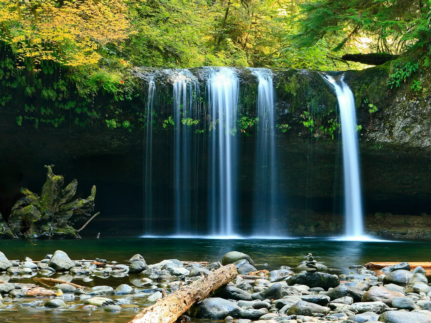
Here, the North and South Forks of the Moorman's River carve their way through ancient rock and dense forest, creating a chain of . There are no lifeguards, no snack bars, no manicured lawns. Just cold, clear mountain water, mossy boulders, and the sound of the river doing what rivers do best. The terrain at Sugar Hollow is wild and honest. Forested ridgelines close in on both sides of the river corridor, and the canopy shifts with the seasons. Lush and deep green in summer, ablaze with color in fall, threaded with wildflowers in spring. The trail system involves moderate effort, with steep sections and uneven footing, so proper footwear is genuinely important here, not just a suggestion.
As you pick your way along the river, the sound of rushing water is a near-constant companion, building anticipation for each new pool around the bend. Wildlife is present and patient. Keep your eyes open for birds, salamanders, and the occasional deer moving through the undergrowth. The Moorman's River runs cold and clear, fed by mountain springs and shaded by overhanging trees, which keeps water temperatures refreshing even in the peak of July and August. Upstream, Big Branch Falls drops roughly 40 feet into a shallower pool. More suited to wading and admiring than deep swimming, but spectacular in its own right, especially in spring when snowmelt amplifies the cascade into something genuinely dramatic. Multiple pools along both forks mean that even on busy weekends, you can often find a quieter stretch of river to claim as your own.
Treat Sugar Hollow as a wild swim: no lifeguard, variable depth, and rules that can change by season.
Key facts
Structured details for trip planning — verify access and fees with the land manager before you visit.
- Water type
- River
- Water body
- Moorman's River; North and South Fork
- Fee
- Free
- Nearest town
- Charlottesville
- State
- Virginia
- Best season
- Summer is a strong choice for . Fall brings stunning foliage, and winter offers solitude for hikers.
- Access difficulty
- Moderate. Trails include steep sections and uneven terrain. Proper footwear and preparation are essential.
- Parking
- Designated area
- Lifeguard
- Present (seasonal)
- Cliff jumping
- Reported
- Camping
- RT 33 goes to Skyline Drive. Big Meadow campground is north on Skyline, Loft Mountain is south. Both are Shenandoah N. P. Campgrounds, tend to be crowded, reservations are available at Big Meadows.
- Activities
- Swimming, Jumping
- Facilities
- No facilities available; you should bring their own water, snacks, and outdoor gear.
- Last verified
- May 12, 2026
The experience
- Best time to visit Summer is a strong choice for . Fall brings stunning foliage, and winter offers solitude for hikers.
- Access Moderate. Trails include steep sections and uneven terrain. Proper footwear and preparation are essential.
- Facilities No facilities available; you should bring their own water, snacks, and outdoor gear.
- Camping nearby RT 33 goes to Skyline Drive. Big Meadow campground is north on Skyline, Loft Mountain is south. Both are Shenandoah N. P. Campgrounds, tend to be crowded, reservations are available at Big Meadows.
Highlights & features
- Multiple swimming holes on North and South Fork Moorman’s River
- Blue Hole: deep pool with rock-jumping opportunities
- Big Branch Falls: 40-foot waterfall with shallow pool
- Picturesque hiking trails with seasonal beauty
- Wildlife spotting and photography opportunities
- Combination of deep swimming holes and cascading waterfalls
- Unspoiled wilderness near Shenandoah National Park
- Opportunities for rock jumping and river exploration
How to get there
Sugar Hollow lies in Virginia near Charlottesville, Waynesboro. Use these driving notes as a starting point and confirm road conditions before you go. : Continue along the trail (now on the right side of the river) for a short distance to reach the next . ) : about 1.8 miles : Continue up the trail, crossing the stream again as you enter Shenandoah National Park . About 2.0 miles : On the Turk Branch Trail, about 0.3 miles in, you’ll find another set of falls where the trail crosses the stream. Note: . Bring water, sunscreen, and gear for a primitive swim day. Weekends and holidays can draw more visitors. Check local updates on access and water levels before you leave home.
-
Driving Directions
From I-64
-
(between Waynesboro and Charlottesville)
-
Take Exit 107 onto Route 250 East toward Crozet.
-
Turn left (north) onto Route 240 , continuing toward Crozet. In Crozet
When Route 240 makes a right turn, continue straight onto Route 810 . Follow Route 810 to the town of White Hall . At White Hall :
-
Turn left (west) onto Route 614 .
Look for an old white building labeled "Piedmont Store." At this point, the main road makes a sharp right turn. Do not follow the main road to the right. Instead, take the smaller road to the left of the store , which is still Route 614, now called Sugar Hollow Road . On Sugar Hollow Road : Follow this road along the Moorman’s River for about 4.7 miles until you reach the Charlottesville Reservoir . Continue driving past the dam and reservoir. Look for a dirt parking area under the trees with signs nearby. This is the parking area for the trails. Trail Information and : Once parked, you will have access to two trails: the North Fork Moorman’s River Trail and the South Fork Moorman’s River Trail . Both trails lead to . North Fork Moorman’s River Trail From the parking area, walk up the continuation of the road you were driving on. Shortly, you will see a sign indicating you are entering Shenandoah National Park . Follow the trail along the North Fork of the Moorman’s River. ") Less than a mile from the parking area, the trail crosses the river for the second time. This is where you’ll find the first .
-
from the parking lot, you’ll reach Big Branch Falls. This 40-foot waterfall has a pool at its base that is 2, 3 feet deep, perfect for cooling off.
South Fork Moorman’s River Trail From the parking area, head south and immediately cross the river using the rocks. Climb up the steep bank on the far side to reach the fire road , which serves as the trail. Follow the fire road uphill, continuing straight (do not take the road that veers off to the left). ") : About 1.5 miles from the parking lot, you’ll find Blue Hole on the right side of the trail. This spot features cascades, a large, deep pool, and surrounding rocks. It is a popular location for . Bathing suits are customary here.
-
from the parking area, you’ll find another set of falls just before the junction with the Turk Branch Trail .
-
Parking and Final Notes
The dirt parking area near the reservoir is the starting point for both trails. Be mindful of trail signs and landmarks to ensure you stay on the correct paths. Please respect the natural environment by packing out all trash and leaving the area as you found it. Coordinates for Blue Hole (): Latitude: 38.1218, Longitude: -78.7645 Google Maps Link Have a safe visit to Sugar Hollow and its beautiful !
Plan your visit
Sugar Hollow works well as a day trip from Charlottesville or Waynesboro. Stock up in town, then head to the water with food, water, and sun protection. Combine the swim with camping at Ben Salem Wayside or browse more Virginia river spots in our directory. For the full list in Virginia, see our state directory.
Access & fees
This is an unofficial, natural area with no fees, facilities, or services. Parking is in a designated dirt lot. The trails and swimming holes are accessed at your own risk. Respect all trail signs, as parts of the route enter Shenandoah National Park.
Top picks for this trip

Hydro Flask Wide Mouth Bottle
A do-everything bottle that holds ice through a full hot day at the water.
Check price on
Willit Rashguard Swim Shirt UPF 50+
The best all-around sun shirt for swimming holes — light enough to swim in, dry enough to hike out in.
Check price onDisclosure: Gear links may earn a commission as an Amazon Associate — at no extra cost to you. Learn more.
What to pack for Sugar Hollow
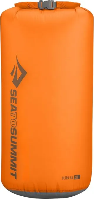
Gear we compare side by side for river swims like this one — water access, sun, and the hike in.



Disclosure: Gear links may earn a commission as an Amazon Associate — at no extra cost to you. Learn more.
Frequently asked questions
Can you swim at Sugar Hollow?
Yes. Sugar Hollow near Charlottesville and Waynesboro in VA is a river swimming spot on Moorman's River; North and South Fork. Scout depth and current before entering — no lifeguards at most natural access points.
Is Sugar Hollow free?
Access is generally free (fee listed as “No”). Confirm any parking or day-use rules on site, and pack out trash.
How do you get to Sugar Hollow?
Sugar Hollow is in VA within day-trip range of Charlottesville and Waynesboro. Use a current map for the put-in or park entrance; cell service can be limited at remote spots.
Explore more nearby swimming guides
Nearby swimming holes
Culture & history
Located near historic Charlottesville and the Appalachian Trail, Sugar Hollow embodies Virginia’s blend of natural and cultural heritage.
Conservation
Follow Leave No Trace principles to protect the area’s fragile ecosystem. Avoid littering and stay on marked trails to reduce erosion.
Sources & updates
Spotted outdated access, fees, or safety info? Send a correction with the page URL — we review every submission.