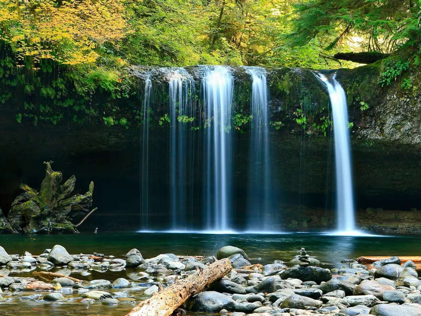
Auburn American River Swimming Spots
Swimming hole in Sacramento, California · River
Auburn American River Swimming Spots is a river swimming hole. It is near Sacramento, California. Access is free. Best season: Spring for dynamic.
Typical season: Spring for dynamic
About Auburn American River Swimming Spots
Near Sacramento in California, Auburn American River Swimming Spots offers a straightforward outdoor swim. Within the Auburn State Recreation Area, the North Fork and Middle Fork of the American River carve their way through dramatic gorges, creating a network of unofficial . Massive granite formations rise from the riverbanks, their surfaces worn smooth by centuries of water and weather. Perfect for sunning yourself between dips or setting up a camera to capture the scene. Sandy shores and rocky outcroppings line the water's edge, while oaks, pines, and a tangle of vibrant riparian flora crowd the canyon walls above. Keep your eyes open: river otters, hawks, and a surprising variety of wildlife call this corridor home. The entire area sits on land steeped in Gold Rush history, and it's easy to let your imagination wander as you wade through the same waters that once drew thousands of fortune-seekers west in the 1850s. Some say the legends of that era still linger in these canyons. Though whether that adds to the atmosphere or gives you a slight chill is entirely up to you. In late spring, snowmelt from the Sierra Nevada sends swift, energetic currents tumbling through the gorge. Exhilarating for confident swimmers who respect moving water, but demanding genuine caution. By summer and into early fall, the river mellows into its most welcoming mood: clearer, calmer pools collect behind boulders and along sandy bends, the water cool and bracingly refreshing against the heat of a foothill afternoon. No lifeguards patrol Auburn American River Swimming Spots. Facilities are limited, so judge depth, current, and weather when you arrive.
Key facts
Structured details for trip planning — verify access and fees with the land manager before you visit.
- Water type
- River
- Water body
- American River
- Fee
- Free
- Nearest town
- Sacramento
- State
- California
- Coordinates
- 38.89459, -121.07399
- Best season
- Spring for dynamic .
- Access difficulty
- Moderate: trails leading to the water.
- Parking
- Designated area
- Restrooms
- Yes
- Lifeguard
- None — assume unguarded
- Camping
- There are several camping places along the river.
- Land manager
- State park / recreation agency
- Activities
- Swimming
- Facilities
- Facilities are limited, so you should come prepared with essentials like water, snacks, and sunscreen. Camping options are available nearby.
- Listing last updated
- May 12, 2026
The experience
- Best time to visitSpring for dynamic .
- AccessModerate: trails leading to the water.
- FacilitiesFacilities are limited, so you should come prepared with essentials like water, snacks, and sunscreen. Camping options are available nearby.
- Camping nearbyThere are several camping places along the river.
Highlights & features
- Cool, clear waters fed by Sierra Nevada snowmelt
- Granite rock formations and sandy shores
- Rich Gold Rush history surrounding the area
- Abundant wildlife and vibrant flora
- Camping opportunities for extended stays
- Historical significance tied to the Gold Rush
- Diverse wildlife including river otters and hawks
- Granite formations perfect for photography
How to get there
Auburn American River Swimming Spots lies in California near Sacramento, Reno (Nv), and Auburn. Use these driving notes as a starting point and confirm road conditions before you go.
Starting Point: Sacramento, CA
Begin by taking Interstate 80 (I-80) eastbound toward Auburn. Continue on I-80 for about 33 miles.
Take Exit 119 for Elm Avenue in Auburn.
At the end of the exit ramp, turn left onto Elm Avenue and follow signs for Highway 49 (CA-49). Turn right onto CA-49 South toward Cool/Placerville.
Final Approach
6. Follow CA-49 South for about 2.5 miles. You will cross the Foresthill Bridge, which is a notable local landmark and the highest bridge in California.
7. Look for parking areas near the American River confluence. There are designated parking lots and roadside parking available, but spaces can fill up quickly during weekends and holidays. Plan to arrive early to secure a spot. Trailhead and Access
8. From the parking area, follow marked trails leading down to the river. Trails are generally well-maintained but can be steep in some sections, so wear sturdy shoes.
9. Popular . Be mindful of posted signs indicating safe .
Additional Notes
Parking fees may apply in certain lots, so bring cash or a credit card for payment.
Restrooms and picnic facilities are available at some parking areas. Pack out all trash and respect the natural environment. Have a safe visit to the Auburn American River ! Bring water, sunscreen, and gear for a primitive swim day. Weekends and holidays can draw more visitors. Check local updates on access and water levels before you leave home.
Plan your visit
Auburn American River Swimming Spots works well as a day trip from Sacramento or Reno (Nv). Stock up in town, then head to the water with food, water, and sun protection. Pair the swim with a stop at Yuba River Swimming Holes And Recreation Area (about 32 mi away) or browse more California river spots in our directory. For the full list in California, see our state directory.
Access & fees
This is an unofficial swimming area with no designated supervision. Parking is available at lots and roadside areas near the river confluence; fees may apply at some lots. Arrive early, especially on weekends, as parking fills quickly. Trails to the water can be steep. wear appropriate footwear.
Frequently asked questions
Can you swim at Auburn American River Swimming Spots?
Yes. Auburn American River Swimming Spots near Sacramento, Reno (Nv), and Auburn in CA is a river swimming spot on American River. Scout depth and current before entering — no lifeguards at most natural access points.
Is Auburn American River Swimming Spots free?
Access is generally free (fee listed as “None”). Confirm any parking or day-use rules on site, and pack out trash.
How do you get to Auburn American River Swimming Spots?
Auburn American River Swimming Spots is in CA within day-trip range of Sacramento, Reno (Nv), and Auburn. Use a current map for the put-in or park entrance; cell service can be limited at remote spots.
Explore more nearby swimming guides
Nearby swimming holes
Map & location
Culture & history
Auburn was a key location during the California Gold Rush, and the area retains historical artifacts and stories that connect visitors to its past.
Conservation
Follow Leave No Trace principles to protect the ecosystem. Avoid disturbing wildlife, pack out all trash, and stay on designated trails.
Sources & updates
Official land managers cited on this page
Always confirm current rules, closures, and fees on the agency site before visiting.
Reference sources
Spotted outdated access, fees, or safety info? Send a correction with the page URL — we review every submission.