Hatchet Creek
Swimming hole in Redding, California · Waterfall
Hatchet Creek is a falls swimming hole. It is near Redding, California. Access is free. Best season: Summer for warm temperatures and swimming, spring for vibrant greenery, fall for quieter visits and changing foliage.
Typical season: Summer for warm temperatures and swimming, spring for vibrant greenery, fall for quieter visits and changing foliage
About Hatchet Creek
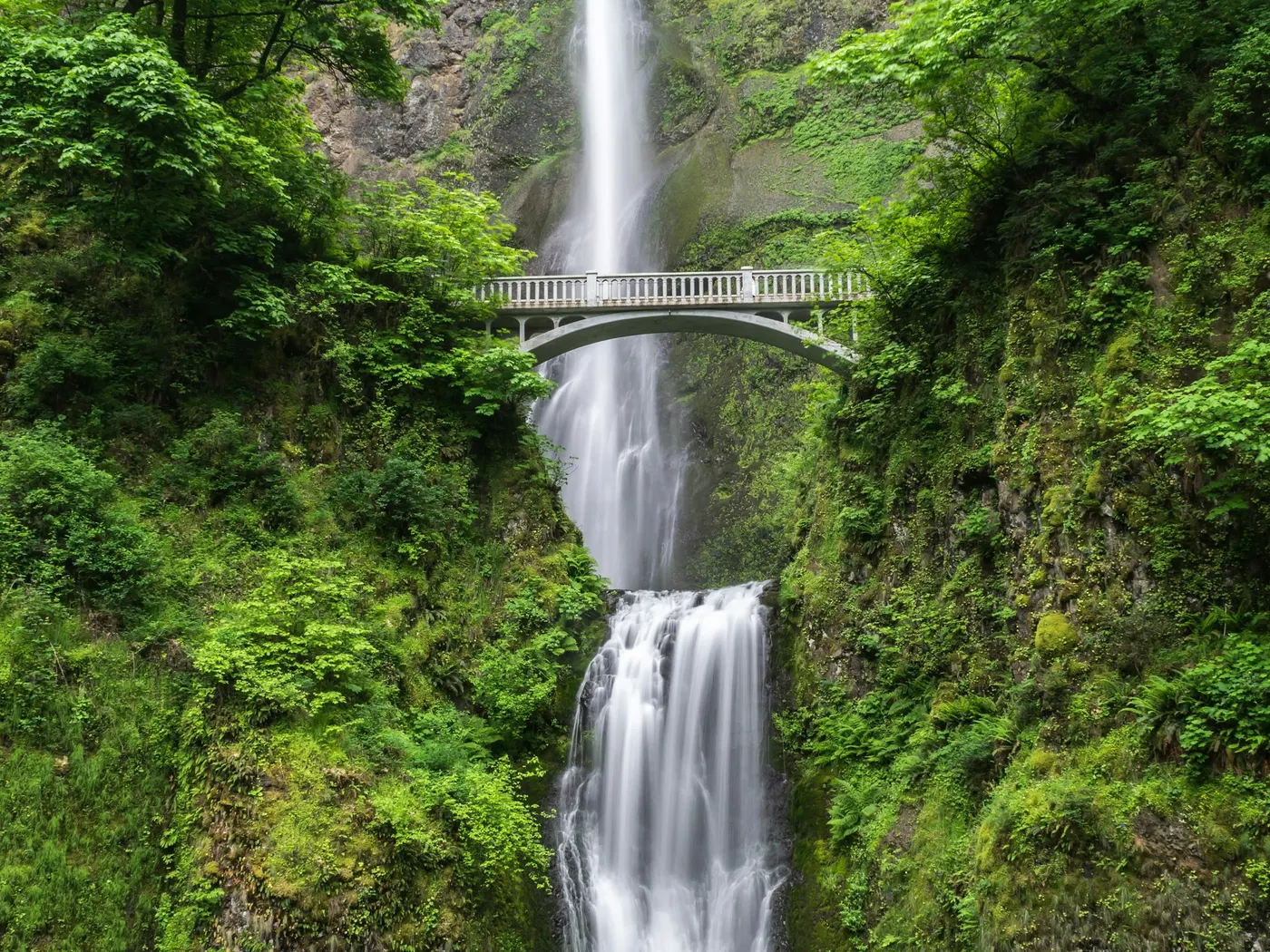
Hatchet Creek is a Falls swimming destination near Redding in California. The setting stays informal and low-key. There are no signs pointing you here, no entry gates, no amenities. Just wild water, dappled sunlight, and the sound of a waterfall doing what it has always done. Getting to Hatchet Creek Falls requires a short but moderately challenging hike through terrain that doesn't come with marked trails or handrails. You'll push through dense brush, pick your way across uneven ground, and then suddenly, the creek opens up before you. In spring, the surrounding hillsides are electric green, fed by snowmelt and seasonal rains. By summer, the foliage deepens and the air smells of warm earth and pine. In fall, the crowds thin further and the leaves shift to amber and gold, making it a stunning destination for photographers and those who simply want stillness. The untouched character of this place is its greatest asset. It feels genuinely discovered rather than designed. Swimmers can wade into the pools beneath the falls, where the water is refreshingly cold even on the hottest summer afternoons. The natural rock formations rise at various heights above the water, offering jumping spots for those with the nerve and the judgment to use them safely. No lifeguards patrol Hatchet Creek. Facilities are limited, so judge depth, current, and weather when you arrive.
Key facts
Structured details for trip planning — verify access and fees with the land manager before you visit.
- Water type
- Falls
- Water body
- Hatchet Creek
- Fee
- Free
- Nearest town
- Redding
- State
- California
- Coordinates
- 40.87175, -121.88696
- Best season
- Summer for warm temperatures and swimming, spring for vibrant greenery, fall for quieter visits and changing foliage. Avoid winter due to accessibility challenges.
- Access difficulty
- Moderate; requires a short hike through rugged terrain. No marked trails or facilities available.
- Parking
- Designated area
- Restrooms
- None on site
- Lifeguard
- None — assume unguarded
- Cliff jumping
- Reported
- Camping
- unknown
- Activities
- Swimming, jumping
- Facilities
- No facilities available. Visitors must bring their own supplies, including food, water, and sunscreen.
- Listing last updated
- May 12, 2026
The experience
- Best time to visitSummer for warm temperatures and swimming, spring for vibrant greenery, fall for quieter visits and changing foliage. Avoid winter due to accessibility challenges.
- AccessModerate; requires a short hike through rugged terrain. No marked trails or facilities available.
- FacilitiesNo facilities available. Visitors must bring their own supplies, including food, water, and sunscreen.
- Camping nearbyunknown
Highlights & features
- Crystal-clear water perfect for swimming
- Opportunities for jumping from rocky ledges
- Untouched wilderness and serene surroundings
- Ideal for photography and wildlife spotting
- Close to Burney Falls and Lassen Volcanic National Park
- Uncrowded and tranquil setting
- Natural rock formations ideal for jumping
- Dappled sunlight filtering through dense vegetation
How to get there
Hatchet Creek lies in California near Redding, Burney. Use these driving notes as a starting point and confirm road conditions before you go. Driving Directions (Summary) - General area is accessible from Highway 299 between Redding and Burney. Specific access points are unmarked; research recent visitor reports or local knowledge for current routes. Parking is informal and roadside; ensure vehicles are completely off the roadway. Final approach typically involves a descent to the creek, which can be steep and slippery. Bring water, sunscreen, and gear for a primitive swim day. Weekends and holidays can draw more visitors. Check local updates on access and water levels before you leave home.
Hatchet Creek lies in California near Redding, Burney. Use these driving notes as a starting point and confirm road conditions before you go. Driving Directions (Summary) - General area is accessible from Highway 299 between Redding and Burney. Specific access points are unmarked; research recent visitor reports or local knowledge for current routes. Parking is informal and roadside; ensure vehicles are completely off the roadway. Final approach typically involves a descent to the creek, which can be steep and slippery. Bring water, sunscreen, and gear for a primitive swim day. Weekends and holidays can draw more visitors. Check local updates on access and water levels before you leave home.
Plan your visit
Hatchet Creek works well as a day trip from Redding or Burney. Stock up in town, then head to the water with food, water, and sun protection. Pair the swim with a stop at Mccloud River Swimming Holes In Northern California (about 19 mi away) or browse more California waterfall spots in our directory. For the full list in California, see our state directory.
Access & fees
This is an unofficial, undeveloped natural area. There is no designated parking, signage, or maintained trail. Access may involve navigating unmarked paths or rugged terrain. Respect private property boundaries and practice Leave No Trace principles. No fee information is confirmed.
Frequently asked questions
Can you swim at Hatchet Creek?
Yes. Hatchet Creek near Redding and Burney in CA has waterfall / cascade pools on Hatchet Creek used for swimming. Rocks are slippery and there are no lifeguards at informal access.
Is Hatchet Creek free?
Access is generally free (fee listed as “none”). Confirm any parking or day-use rules on site, and pack out trash.
How do you get to Hatchet Creek?
Hatchet Creek is in CA within day-trip range of Redding and Burney. Use a current map for the put-in or park entrance; cell service can be limited at remote spots.
Explore more nearby swimming guides
Nearby swimming holes
Map & location
Culture & history
Located near Redding, the cultural hub of Northern California, and Burney, a town known for its proximity to Burney Falls. The area reflects the natural and historical richness of the Shasta Cascade region.
Conservation
Practice Leave No Trace principles: pack out trash, avoid disturbing wildlife, and respect vegetation. Ensure the natural beauty of Hatchet Creek is preserved.
Sources & updates
Reference sources
Spotted outdated access, fees, or safety info? Send a correction with the page URL — we review every submission.